Bang Khun Thian geodata
Bang Khun Thian (Bangkok) is a seat of a second-order administrative division; located in Thailand in Asia/Bangkok (GMT+7) time zone. In our database, there are 331 cities with bigger population. Compared to other cities in Thailand, 72.9% of cities are located further ↑North; 60.6% of cities are located further →East and 91.2% of cities have higher elevation than Bang Khun Thian. Note1


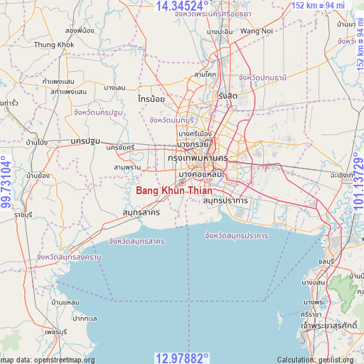
Bang Khun Thian GPS coordinates[2]
13° 39' 46.872" North, 100° 26' 2.976" East
| Map corner | latitude | longitude |
|---|---|---|
| Upper-left | 14.34524°, | 99.73104° |
| Center: | 13.66302°, | 100.43416° |
| Lower-right: | 12.97882°, | 101.13729° |
| Map W x H: | 151.9×151.9 km | = 94.4×94.4mi |
| max Lat: | 20.43353° ⇑72.9% North |
| Bang Khun Thian: | 13.66302° |
| min Lat: | ⇓27.1% South 5.77434° |
| min Long | Bang Khun Thian | max Long |
| 97.93288° | 100.43416° | 105.49506° |
| W 39.4%⇐ | ⇒60.6% E |
Elevation
Elevation of Bang Khun Thian is 8 m = 26 ft, and this is 117.5 m = 385 ft below average elevation for this country.
| Max E: |
1011 m = 3317 ft | 91.2% |
| Avg. | 125.5 m = 412 ft | |
| Bang Khun Thian | 8 m = 26 ft | |
Min E: |
1 m = 3 ft | 8.8% |
See also: Thailand elevation on elevation.city.
Geographical zone
Bang Khun Thian is located in North Torrid zone (between Equator and Tropic of Cancer). Distance of this Northern Tropic circle is 1086.7 km =675.2 mi to North.| Distance of | km | miles | from Bang Khun Thian |
|---|---|---|---|
| North Pole | 8487.9 | 5274.1 | to North |
| Arctic Circle | 5882 | 3654.9 | to North |
| Tropic Cancer | 1086.7 | 675.2 | to North |
| Equator | 1519.2 | 944 | to South |


Nearby cities:
15 places around Bang Khun Thian: (largest is in red/bold)
• Bang Bon
4.2 km =2.6 mi,  268°
268°
• Bang Khae
4.4 km =2.7 mi,  317°
317°
• Bang Kho Laem
8.1 km =5 mi,  65°
65°
• Bangkok Noi
12 km =7.5 mi,  23°
23°
• Bangkok Yai
8.1 km =5 mi,  34°
34°
• Chom Thong
5.6 km =3.5 mi, 73°
• Khlong San
11.1 km =6.9 mi,  46°
46°
• Nong Khaem
10.3 km =6.4 mi,  297°
297°
• Phasi Charoen
5.7 km =3.5 mi,  2°
2°
• Phra Pradaeng
10.8 km =6.7 mi,  92°
92°
• Rat Burana
8.1 km =5 mi, 74°
• Samphanthawong
11.5 km =7.1 mi, 48°
• Sathon
11.2 km =7 mi,  63°
63°
• Thon Buri
8.8 km =5.5 mi,  38°
38°
• Thung Khru
9 km =5.6 mi,  115°
115°
Sources, notices
• [Note1] Compared only with cities in Thailand existing in our database
• [Src1] Map data: © OpenStreetMap contributors (CC-BY-SA)
• [Src2] Other city data from geonames.org with taken over terms of usage.
• [Src3] Geographical zone / Annual Mean Temperature by Robert A. Rohde @ Wikipedia
