Bang Kho Laem geodata
Bang Kho Laem (Bangkok) is a seat of a second-order administrative division; located in Thailand in Asia/Bangkok (GMT+7) time zone. In our database, there are 331 cities with bigger population. Compared to other cities in Thailand, 72% of cities are located further ↑North; 58.1% of cities are located further →East and 91.2% of cities have higher elevation than Bang Kho Laem. Note1


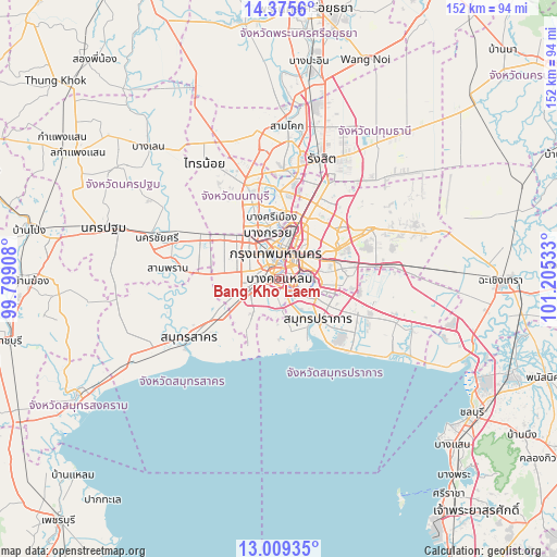
Bang Kho Laem GPS coordinates[2]
13° 41' 36.492" North, 100° 30' 7.92" East
| Map corner | latitude | longitude |
|---|---|---|
| Upper-left | 14.3756°, | 99.79908° |
| Center: | 13.69347°, | 100.5022° |
| Lower-right: | 13.00935°, | 101.20533° |
| Map W x H: | 151.9×151.9 km | = 94.4×94.4mi |
| max Lat: | 20.43353° ⇑72% North |
| Bang Kho Laem: | 13.69347° |
| min Lat: | ⇓28% South 5.77434° |
| min Long | Bang Kho Laem | max Long |
| 97.93288° | 100.5022° | 105.49506° |
| W 41.9%⇐ | ⇒58.1% E |
Elevation
Elevation of Bang Kho Laem is 8 m = 26 ft, and this is 117.5 m = 385 ft below average elevation for this country.
| Max E: |
1011 m = 3317 ft | 91.2% |
| Avg. | 125.5 m = 412 ft | |
| Bang Kho Laem | 8 m = 26 ft | |
Min E: |
1 m = 3 ft | 8.8% |
See also: Thailand elevation on elevation.city.
Geographical zone
Bang Kho Laem is located in North Torrid zone (between Equator and Tropic of Cancer). Distance of this Northern Tropic circle is 1083.3 km =673.1 mi to North.| Distance of | km | miles | from Bang Kho Laem |
|---|---|---|---|
| North Pole | 8484.5 | 5272 | to North |
| Arctic Circle | 5878.6 | 3652.8 | to North |
| Tropic Cancer | 1083.3 | 673.1 | to North |
| Equator | 1522.6 | 946.1 | to South |


Nearby cities:
15 places around Bang Kho Laem: (largest is in red/bold)
• Bang Rak
4.7 km =2.9 mi,  29°
29°
• Bangkok
6.7 km =4.2 mi,  359°
359°
• Bangkok Yai
4.4 km =2.7 mi,  319°
319°
• Chom Thong
2.7 km =1.7 mi,  227°
227°
• Khlong San
4.2 km =2.6 mi,  10°
10°
• Pathum Wan
5.3 km =3.3 mi, 26°
• Phasi Charoen
7.4 km =4.6 mi,  288°
288°
• Phra Pradaeng
5.2 km =3.2 mi,  138°
138°
• Pom Prap Sattru Phai
7.3 km =4.5 mi, 9°
• Rat Burana
1.3 km =0.8 mi,  161°
161°
• Samphanthawong
4.4 km =2.7 mi,  16°
16°
• Sathon
3.1 km =1.9 mi,  57°
57°
• Thon Buri
4 km =2.5 mi,  332°
332°
• Thung Khru
7.2 km =4.5 mi,  173°
173°
• Yan Nawa
4.3 km =2.7 mi,  85°
85°
Sources, notices
• [Note1] Compared only with cities in Thailand existing in our database
• [Src1] Map data: © OpenStreetMap contributors (CC-BY-SA)
• [Src2] Other city data from geonames.org with taken over terms of usage.
• [Src3] Geographical zone / Annual Mean Temperature by Robert A. Rohde @ Wikipedia
