Takelsa geodata
Takelsa (Nābul) is a populated place; located in Tunisia in Africa/Tunis (GMT+1) time zone. With population of 20,659 people, there are 54 cities with bigger population in this country. Compared to other cities in Tunisia, 81.8% of cities are located further ↓South; 69.9% of cities are located further ←West and 69.2% of cities have lower elevation than Takelsa. Note1


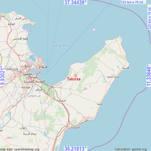
Takelsa GPS coordinates[2]
36° 46' 59.988" North, 10° 37' 59.988" East
| Map corner | latitude | longitude |
|---|---|---|
| Upper-left | 37.34439°, | 9.93021° |
| Center: | 36.78333°, | 10.63333° |
| Lower-right: | 36.21813°, | 11.33646° |
| Map W x H: | 125.2×125.2 km | = 77.8×77.8mi |
| max Lat: | 37.27442° ⇑18.2% North |
| Takelsa: | 36.78333° |
| min Lat: | ⇓81.8% South 32.31662° |
| min Long | Takelsa | max Long |
| 7.87765° | 10.63333° | 11.21965° |
| W 69.9%⇐ | ⇒30.1% E |
Elevation
Elevation of Takelsa is 121 m = 397 ft, and this is 28.4 m = 93 ft below average elevation for this country.
| Max E: |
999 m = 3278 ft | 30.8% |
| Avg. | 149.4 m = 490 ft | |
| Takelsa | 121 m = 397 ft | |
Min E: |
-6 m = -20 ft | 69.2% |
See also: Tunisia elevation on elevation.city.
Geographical zone
Takelsa is located in North temperate zone (between Tropic of Cancer and the Arctic Circle). Distance of this Northern Tropic circle is 1484 km =922.1 mi to South.| Distance of | km | miles | from Takelsa |
|---|---|---|---|
| North Pole | 5917.1 | 3676.7 | to North |
| Arctic Circle | 3311.3 | 2057.5 | to North |
| Tropic Cancer | 1484 | 922.1 | to South |
| Equator | 4089.9 | 2541.3 | to South |


Nearby cities:
15 places around Takelsa: (largest is in red/bold)
• Al Marsá
29.4 km =18.3 mi,  291°
291°
• Beni Khalled
15.3 km =9.5 mi,  194°
194°
• Bou Arkoub
28.2 km =17.5 mi,  195°
195°
• Carthage
28.2 km =17.5 mi, 287°
• El Mida
20.8 km =12.9 mi,  107°
107°
• Hammam-Lif
26.7 km =16.6 mi,  256°
256°
• Korba
30.4 km =18.9 mi,  138°
138°
• Korbous
6.8 km =4.2 mi,  302°
302°
• La Goulette
29.5 km =18.3 mi,  277°
277°
• La Sebala du Mornag
32.5 km =20.2 mi,  249°
249°
• Mennzel Bou Zelfa
12 km =7.5 mi, 201°
• Menzel Heurr
29.5 km =18.3 mi,  101°
101°
• Radès
32 km =19.9 mi,  267°
267°
• Sidi Bou Saïd
27.6 km =17.1 mi, 290°
• Zaouiat Djedidi
16.4 km =10.2 mi, 198°
Sources, notices
• [Note1] Compared only with cities in Tunisia existing in our database
• [Src1] Map data: © OpenStreetMap contributors (CC-BY-SA)
• [Src2] Other city data from geonames.org with taken over terms of usage.
• [Src3] Geographical zone / Annual Mean Temperature by Robert A. Rohde @ Wikipedia
