Yaylacık geodata
Yaylacık (Mardin) is a populated place; located in Turkey in Europe/Istanbul (GMT+3) time zone. With population of 588 people, there are 1261 cities with bigger population in this country. Compared to other cities in Turkey, 76.5% of cities are located further ↑North; 78.2% of cities are located further ←West and 74.5% of cities have lower elevation than Yaylacık. Note1


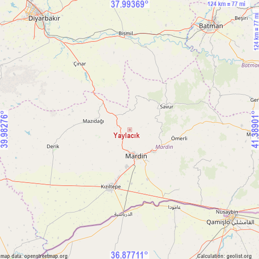
Yaylacık GPS coordinates[2]
37° 26' 14.928" North, 40° 41' 9.168" East
| Map corner | latitude | longitude |
|---|---|---|
| Upper-left | 37.99369°, | 39.98276° |
| Center: | 37.43748°, | 40.68588° |
| Lower-right: | 36.87711°, | 41.38901° |
| Map W x H: | 124.2×124.2 km | = 77.2×77.2mi |
| max Lat: | 42.02683° ⇑76.5% North |
| Yaylacık: | 37.43748° |
| min Lat: | ⇓23.5% South 35.9025° |
| min Long | Yaylacık | max Long |
| 25.90902° | 40.68588° | 44.60099° |
| W 78.2%⇐ | ⇒21.8% E |
Elevation
Elevation of Yaylacık is 1096 m = 3596 ft, and this is 378.6 m = 1242 ft above average elevation for this country.
| Max E: |
2682 m = 8799 ft | 25.5% |
| Yaylacık | 1096 m 3596 ft | |
| Avg. | 717.4 m = 2354 ft | |
Min E: |
0 m = 0 ft | 74.5% |
See also: Turkey elevation on elevation.city.
Geographical zone
Yaylacık is located in North temperate zone (between Tropic of Cancer and the Arctic Circle). Distance of this Northern Tropic circle is 1556.7 km =967.3 mi to South.| Distance of | km | miles | from Yaylacık |
|---|---|---|---|
| North Pole | 5844.4 | 3631.5 | to North |
| Arctic Circle | 3238.5 | 2012.3 | to North |
| Tropic Cancer | 1556.7 | 967.3 | to South |
| Equator | 4162.7 | 2586.6 | to South |


Nearby cities:
15 places around Yaylacık: (largest is in red/bold)
• Aran
5.6 km =3.5 mi,  78°
78°
• Avine
15.7 km =9.8 mi,  15°
15°
• Bağlıca
10 km =6.2 mi,  0°
0°
• Cevizlik
11.8 km =7.3 mi,  241°
241°
• Cevizpınarı
11.3 km =7 mi,  131°
131°
• Cillin
17.5 km =10.9 mi,  359°
359°
• Dereyanı
15.5 km =9.6 mi,  94°
94°
• Eryeri
16.7 km =10.4 mi,  161°
161°
• Kabala
14.4 km =8.9 mi,  135°
135°
• Mardin
14.7 km =9.1 mi, 159°
• Mazıdağı
18.6 km =11.6 mi,  284°
284°
• Pınardere
13.6 km =8.5 mi,  73°
73°
• Yeşilalan
9.1 km =5.7 mi, 73°
• Yeşilli
16 km =9.9 mi, 133°
• Çınaraltı
16.4 km =10.2 mi,  110°
110°
Sources, notices
• [Note1] Compared only with cities in Turkey existing in our database
• [Src1] Map data: © OpenStreetMap contributors (CC-BY-SA)
• [Src2] Other city data from geonames.org with taken over terms of usage.
• [Src3] Geographical zone / Annual Mean Temperature by Robert A. Rohde @ Wikipedia
