Silopi geodata
Silopi (Şırnak) is a seat of a second-order administrative division; located in Turkey in Europe/Istanbul (GMT+3) time zone. With population of 74,798 people, there are 122 cities with bigger population in this country. Compared to other cities in Turkey, 82% of cities are located further ↑North; 94% of cities are located further ←West and 61.1% of cities have higher elevation than Silopi. Note1


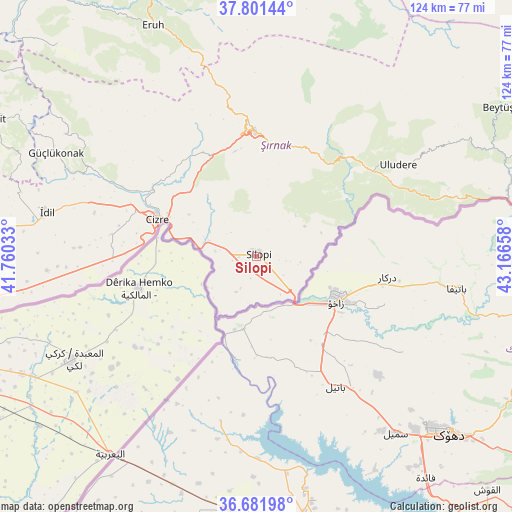
Silopi GPS coordinates[2]
37° 14' 37.644" North, 42° 27' 48.42" East
| Map corner | latitude | longitude |
|---|---|---|
| Upper-left | 37.80144°, | 41.76033° |
| Center: | 37.24379°, | 42.46345° |
| Lower-right: | 36.68198°, | 43.16658° |
| Map W x H: | 124.5×124.5 km | = 77.4×77.4mi |
| max Lat: | 42.02683° ⇑82% North |
| Silopi: | 37.24379° |
| min Lat: | ⇓18% South 35.9025° |
| min Long | Silopi | max Long |
| 25.90902° | 42.46345° | 44.60099° |
| W 94%⇐ | ⇒6% E |
Elevation
Elevation of Silopi is 492 m = 1614 ft, and this is 225.4 m = 740 ft below average elevation for this country.
| Max E: |
2682 m = 8799 ft | 61.1% |
| Avg. | 717.4 m = 2354 ft | |
| Silopi | 492 m = 1614 ft | |
Min E: |
0 m = 0 ft | 38.9% |
See also: Silopi elevation on elevation.city.
Geographical zone
Silopi is located in North temperate zone (between Tropic of Cancer and the Arctic Circle). Distance of this Northern Tropic circle is 1535.2 km =953.9 mi to South.| Distance of | km | miles | from Silopi |
|---|---|---|---|
| North Pole | 5865.9 | 3644.9 | to North |
| Arctic Circle | 3260.1 | 2025.7 | to North |
| Tropic Cancer | 1535.2 | 953.9 | to South |
| Equator | 4141.1 | 2573.2 | to South |


Nearby cities:
15 places around Silopi: (largest is in red/bold)
• Balveren
27.7 km =17.2 mi,  15°
15°
• Bisbin
14.2 km =8.8 mi,  41°
41°
• Bostancı
14 km =8.7 mi,  238°
238°
• Bozalan
20 km =12.4 mi,  298°
298°
• Buğdaylı
9.8 km =6.1 mi,  211°
211°
• Cizre
26.5 km =16.5 mi,  291°
291°
• Doruklu
11.4 km =7.1 mi,  276°
276°
• Girikbedro
8 km =5 mi, 207°
• Kavallı
5.3 km =3.3 mi,  227°
227°
• Ortaköy
5.3 km =3.3 mi,  195°
195°
• Razvaliny Ayinvan
12.1 km =7.5 mi, 289°
• Rubaikale
10.7 km =6.6 mi,  255°
255°
• Yeniköy
4.6 km =2.9 mi,  311°
311°
• Çalışkan
16.9 km =10.5 mi,  69°
69°
• Çardaklı
10.8 km =6.7 mi,  97°
97°
Sources, notices
• [Note1] Compared only with cities in Turkey existing in our database
• [Src1] Map data: © OpenStreetMap contributors (CC-BY-SA)
• [Src2] Other city data from geonames.org with taken over terms of usage.
• [Src3] Geographical zone / Annual Mean Temperature by Robert A. Rohde @ Wikipedia
