Buğdaylı geodata
Buğdaylı (Şırnak) is a populated place; located in Turkey in Europe/Istanbul (GMT+3) time zone. With population of 944 people, there are 1103 cities with bigger population in this country. Compared to other cities in Turkey, 84.4% of cities are located further ↑North; 93.4% of cities are located further ←West and 66.6% of cities have higher elevation than Buğdaylı. Note1


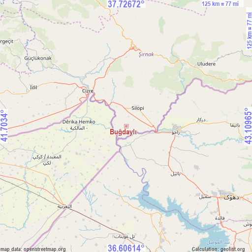
Buğdaylı GPS coordinates[2]
37° 10' 6.636" North, 42° 24' 23.472" East
| Map corner | latitude | longitude |
|---|---|---|
| Upper-left | 37.72672°, | 41.7034° |
| Center: | 37.16851°, | 42.40652° |
| Lower-right: | 36.60614°, | 43.10965° |
| Map W x H: | 124.6×124.6 km | = 77.4×77.4mi |
| max Lat: | 42.02683° ⇑84.4% North |
| Buğdaylı: | 37.16851° |
| min Lat: | ⇓15.6% South 35.9025° |
| min Long | Buğdaylı | max Long |
| 25.90902° | 42.40652° | 44.60099° |
| W 93.4%⇐ | ⇒6.6% E |
Elevation
Elevation of Buğdaylı is 381 m = 1250 ft, and this is 336.4 m = 1104 ft below average elevation for this country.
| Max E: |
2682 m = 8799 ft | 66.6% |
| Avg. | 717.4 m = 2354 ft | |
| Buğdaylı | 381 m = 1250 ft | |
Min E: |
0 m = 0 ft | 33.4% |
See also: Turkey elevation on elevation.city.
Geographical zone
Buğdaylı is located in North temperate zone (between Tropic of Cancer and the Arctic Circle). Distance of this Northern Tropic circle is 1526.8 km =948.7 mi to South.| Distance of | km | miles | from Buğdaylı |
|---|---|---|---|
| North Pole | 5874.3 | 3650.1 | to North |
| Arctic Circle | 3268.4 | 2030.9 | to North |
| Tropic Cancer | 1526.8 | 948.7 | to South |
| Equator | 4132.8 | 2568 | to South |


Nearby cities:
15 places around Buğdaylı: (largest is in red/bold)
• Bisbin
23.8 km =14.8 mi,  37°
37°
• Bostancı
6.9 km =4.3 mi,  278°
278°
• Bozalan
21.8 km =13.5 mi,  324°
324°
• Cizre
26.6 km =16.5 mi,  312°
312°
• Doruklu
11.6 km =7.2 mi,  326°
326°
• Girikbedro
1.8 km =1.1 mi, 44°
• Kavallı
4.9 km =3 mi,  13°
13°
• Ortaköy
4.9 km =3 mi,  48°
48°
• Razvaliny Ayinvan
13.9 km =8.6 mi, 332°
• Rubaikale
7.9 km =4.9 mi, 316°
• Silopi
9.8 km =6.1 mi,  31°
31°
• Sulak
27.7 km =17.2 mi,  300°
300°
• Yeniköy
11.5 km =7.1 mi, 8°
• Çalışkan
25.3 km =15.7 mi,  55°
55°
• Çardaklı
17.2 km =10.7 mi,  66°
66°
Sources, notices
• [Note1] Compared only with cities in Turkey existing in our database
• [Src1] Map data: © OpenStreetMap contributors (CC-BY-SA)
• [Src2] Other city data from geonames.org with taken over terms of usage.
• [Src3] Geographical zone / Annual Mean Temperature by Robert A. Rohde @ Wikipedia
