Hıdırbey geodata
Hıdırbey (Hatay) is a seat of a third-order administrative division; located in Turkey in Europe/Istanbul (GMT+3) time zone. In our database, there are 1323 cities with bigger population. Compared to other cities in Turkey, 98.5% of cities are located further ↑North; 51.2% of cities are located further ←West and 78.8% of cities have higher elevation than Hıdırbey. Note1


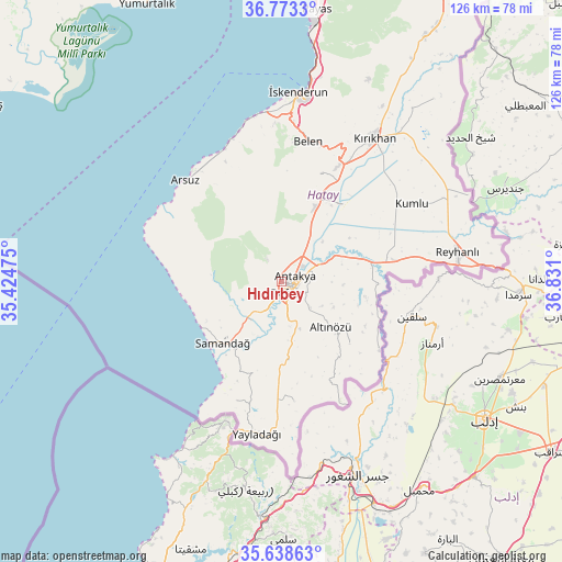
Hıdırbey GPS coordinates[2]
36° 12' 28.872" North, 36° 7' 40.332" East
| Map corner | latitude | longitude |
|---|---|---|
| Upper-left | 36.7733°, | 35.42475° |
| Center: | 36.20802°, | 36.12787° |
| Lower-right: | 35.63863°, | 36.831° |
| Map W x H: | 126.2×126.2 km | = 78.4×78.4mi |
| max Lat: | 42.02683° ⇑98.5% North |
| Hıdırbey: | 36.20802° |
| min Lat: | ⇓1.5% South 35.9025° |
| min Long | Hıdırbey | max Long |
| 25.90902° | 36.12787° | 44.60099° |
| W 51.2%⇐ | ⇒48.8% E |
Elevation
Elevation of Hıdırbey is 125 m = 410 ft, and this is 592.4 m = 1944 ft below average elevation for this country.
| Max E: |
2682 m = 8799 ft | 78.8% |
| Avg. | 717.4 m = 2354 ft | |
| Hıdırbey | 125 m = 410 ft | |
Min E: |
0 m = 0 ft | 21.2% |
See also: Turkey elevation on elevation.city.
Geographical zone
Hıdırbey is located in North temperate zone (between Tropic of Cancer and the Arctic Circle). Distance of this Northern Tropic circle is 1420 km =882.3 mi to South.| Distance of | km | miles | from Hıdırbey |
|---|---|---|---|
| North Pole | 5981.1 | 3716.5 | to North |
| Arctic Circle | 3375.2 | 2097.3 | to North |
| Tropic Cancer | 1420 | 882.3 | to South |
| Equator | 4026 | 2501.6 | to South |


Nearby cities:
15 places around Hıdırbey: (largest is in red/bold)
• Antakya
2.6 km =1.6 mi,  93°
93°
• Aşağıokçular
3.5 km =2.2 mi,  161°
161°
• Doğanköy
3.2 km =2 mi,  328°
328°
• Dursunlu
5.3 km =3.3 mi,  149°
149°
• Gümüşgöze
6.7 km =4.2 mi,  176°
176°
• Güneysöğüt
4.1 km =2.5 mi,  200°
200°
• Günyazı
3 km =1.9 mi,  340°
340°
• Hancağız
7.2 km =4.5 mi,  213°
213°
• Harbiye
7.9 km =4.9 mi, 176°
• Karaçay
9.2 km =5.7 mi, 209°
• Kuzeytepe
6.7 km =4.2 mi,  19°
19°
• Mansurlu
9.3 km =5.8 mi,  81°
81°
• Samankaya
6.4 km =4 mi, 179°
• Toygarlı
5 km =3.1 mi,  275°
275°
• Çanakoluk
8 km =5 mi,  234°
234°
Sources, notices
• [Note1] Compared only with cities in Turkey existing in our database
• [Src1] Map data: © OpenStreetMap contributors (CC-BY-SA)
• [Src2] Other city data from geonames.org with taken over terms of usage.
• [Src3] Geographical zone / Annual Mean Temperature by Robert A. Rohde @ Wikipedia
