Kaptanpaşa geodata
Kaptanpaşa (Rize) is a seat of a third-order administrative division; located in Turkey in Europe/Istanbul (GMT+3) time zone. In our database, there are 1323 cities with bigger population. Compared to other cities in Turkey, 88% of cities are located further ↓South; 79.3% of cities are located further ←West and 62.7% of cities have higher elevation than Kaptanpaşa. Note1


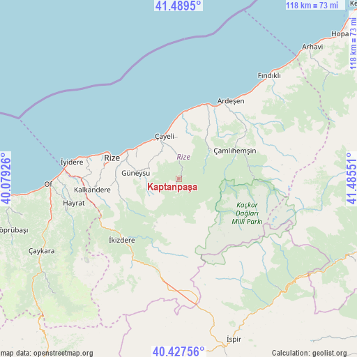
Kaptanpaşa GPS coordinates[2]
40° 57' 38.412" North, 40° 46' 56.568" East
| Map corner | latitude | longitude |
|---|---|---|
| Upper-left | 41.4895°, | 40.07926° |
| Center: | 40.96067°, | 40.78238° |
| Lower-right: | 40.42756°, | 41.48551° |
| Map W x H: | 118.1×118.1 km | = 73.4×73.4mi |
| max Lat: | 42.02683° ⇑12% North |
| Kaptanpaşa: | 40.96067° |
| min Lat: | ⇓88% South 35.9025° |
| min Long | Kaptanpaşa | max Long |
| 25.90902° | 40.78238° | 44.60099° |
| W 79.3%⇐ | ⇒20.7% E |
Elevation
Elevation of Kaptanpaşa is 458 m = 1503 ft, and this is 259.4 m = 851 ft below average elevation for this country.
| Max E: |
2682 m = 8799 ft | 62.7% |
| Avg. | 717.4 m = 2354 ft | |
| Kaptanpaşa | 458 m = 1503 ft | |
Min E: |
0 m = 0 ft | 37.3% |
See also: Turkey elevation on elevation.city.
Geographical zone
Kaptanpaşa is located in North temperate zone (between Tropic of Cancer and the Arctic Circle). Distance of this Northern Tropic circle is 1948.5 km =1210.7 mi to South.| Distance of | km | miles | from Kaptanpaşa |
|---|---|---|---|
| North Pole | 5452.7 | 3388.1 | to North |
| Arctic Circle | 2846.8 | 1768.9 | to North |
| Tropic Cancer | 1948.5 | 1210.7 | to South |
| Equator | 4554.4 | 2830 | to South |


Nearby cities:
15 places around Kaptanpaşa: (largest is in red/bold)
• Ardeşen
30.9 km =19.2 mi,  33°
33°
• Büyükköy
11 km =6.8 mi,  303°
303°
• Derepazarı
30.9 km =19.2 mi,  283°
283°
• Gündoğdu
18 km =11.2 mi, 304°
• Güneyce
30.5 km =19 mi,  239°
239°
• Güneysu
15.1 km =9.4 mi, 278°
• Hemşin
13.7 km =8.5 mi,  45°
45°
• Kalkandere
29.4 km =18.3 mi,  261°
261°
• Nurluca
13.3 km =8.3 mi, 51°
• Pazar
25.7 km =16 mi,  19°
19°
• Rize
22.9 km =14.2 mi,  287°
287°
• Çamlıhemşin
20.7 km =12.9 mi,  62°
62°
• Çayeli
14.8 km =9.2 mi,  340°
340°
• İkizdere
28.3 km =17.6 mi,  223°
223°
• İyidere
35.8 km =22.2 mi, 279°
Sources, notices
• [Note1] Compared only with cities in Turkey existing in our database
• [Src1] Map data: © OpenStreetMap contributors (CC-BY-SA)
• [Src2] Other city data from geonames.org with taken over terms of usage.
• [Src3] Geographical zone / Annual Mean Temperature by Robert A. Rohde @ Wikipedia
