Nurluca geodata
Nurluca (Rize) is a populated place; located in Turkey in Europe/Istanbul (GMT+3) time zone. With population of 3,354 people, there are 832 cities with bigger population in this country. Compared to other cities in Turkey, 90.5% of cities are located further ↓South; 80.4% of cities are located further ←West and 56.7% of cities have higher elevation than Nurluca. Note1


Nurluca GPS coordinates[2]
41° 2' 6.684" North, 40° 54' 21.024" East
| Map corner | latitude | longitude |
|---|---|---|
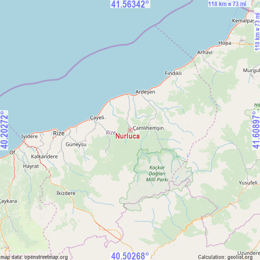
| Upper-left | 41.56342°, | 40.20272° |
| Center: | 41.03519°, | 40.90584° |
| Lower-right: | 40.50268°, | 41.60897° |
| Map W x H: | 117.9×117.9 km | = 73.3×73.3mi |
| max Lat: | 42.02683° ⇑9.5% North |
| Nurluca: | 41.03519° |
| min Lat: | ⇓90.5% South 35.9025° |
| min Long | Nurluca | max Long |
| 25.90902° | 40.90584° | 44.60099° |
| W 80.4%⇐ | ⇒19.6% E |
Elevation
Elevation of Nurluca is 560 m = 1837 ft, and this is 157.4 m = 516 ft below average elevation for this country.
| Max E: |
2682 m = 8799 ft | 56.7% |
| Avg. | 717.4 m = 2354 ft | |
| Nurluca | 560 m = 1837 ft | |
Min E: |
0 m = 0 ft | 43.3% |
See also: Turkey elevation on elevation.city.
Geographical zone
Nurluca is located in North temperate zone (between Tropic of Cancer and the Arctic Circle). Distance of this Northern Tropic circle is 1956.8 km =1215.9 mi to South.| Distance of | km | miles | from Nurluca |
|---|---|---|---|
| North Pole | 5444.4 | 3383 | to North |
| Arctic Circle | 2838.5 | 1763.8 | to North |
| Tropic Cancer | 1956.8 | 1215.9 | to South |
| Equator | 4562.7 | 2835.1 | to South |


Nearby cities:
15 places around Nurluca: (largest is in red/bold)
• Ardeşen
18.6 km =11.6 mi,  21°
21°
• Büyükköy
19.7 km =12.2 mi,  263°
263°
• Derepazarı
40.5 km =25.2 mi,  268°
268°
• Fındıklı
32.6 km =20.3 mi,  37°
37°
• Gündoğdu
25.2 km =15.7 mi, 274°
• Güneyce
43.7 km =27.2 mi,  236°
236°
• Güneysu
26 km =16.2 mi, 256°
• Hemşin
1.5 km =0.9 mi,  335°
335°
• Kalkandere
41.4 km =25.7 mi,  252°
252°
• Kaptanpaşa
13.3 km =8.3 mi,  231°
231°
• Pazar
16.1 km =10 mi,  353°
353°
• Rize
32.2 km =20 mi, 267°
• Çamlıhemşin
8 km =5 mi,  80°
80°
• Çayeli
16.4 km =10.2 mi,  290°
290°
• İkizdere
41.5 km =25.8 mi, 225°
Sources, notices
• [Note1] Compared only with cities in Turkey existing in our database
• [Src1] Map data: © OpenStreetMap contributors (CC-BY-SA)
• [Src2] Other city data from geonames.org with taken over terms of usage.
• [Src3] Geographical zone / Annual Mean Temperature by Robert A. Rohde @ Wikipedia
