Çekmeköy geodata
Çekmeköy (Istanbul) is a seat of a second-order administrative division; located in Turkey in Europe/Istanbul (GMT+3) time zone. In our database, there are 1323 cities with bigger population. Compared to other cities in Turkey, 90.7% of cities are located further ↓South; 82.1% of cities are located further →East and 74.9% of cities have higher elevation than Çekmeköy. Note1


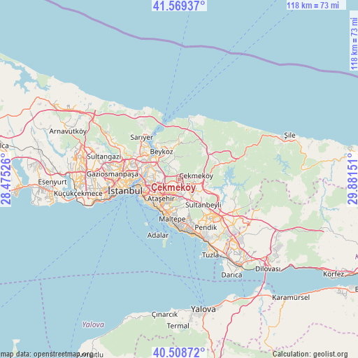
Çekmeköy GPS coordinates[2]
41° 2' 28.248" North, 29° 10' 42.168" East
| Map corner | latitude | longitude |
|---|---|---|
| Upper-left | 41.56937°, | 28.47526° |
| Center: | 41.04118°, | 29.17838° |
| Lower-right: | 40.50872°, | 29.88151° |
| Map W x H: | 117.9×117.9 km | = 73.3×73.3mi |
| max Lat: | 42.02683° ⇑9.3% North |
| Çekmeköy: | 41.04118° |
| min Lat: | ⇓90.7% South 35.9025° |
| min Long | Çekmeköy | max Long |
| 25.90902° | 29.17838° | 44.60099° |
| W 17.9%⇐ | ⇒82.1% E |
Elevation
Elevation of Çekmeköy is 177 m = 581 ft, and this is 540.4 m = 1773 ft below average elevation for this country.
| Max E: |
2682 m = 8799 ft | 74.9% |
| Avg. | 717.4 m = 2354 ft | |
| Çekmeköy | 177 m = 581 ft | |
Min E: |
0 m = 0 ft | 25.1% |
See also: Turkey elevation on elevation.city.
Geographical zone
Çekmeköy is located in North temperate zone (between Tropic of Cancer and the Arctic Circle). Distance of this Northern Tropic circle is 1957.4 km =1216.3 mi to South.| Distance of | km | miles | from Çekmeköy |
|---|---|---|---|
| North Pole | 5443.7 | 3382.6 | to North |
| Arctic Circle | 2837.8 | 1763.3 | to North |
| Tropic Cancer | 1957.4 | 1216.3 | to South |
| Equator | 4563.4 | 2835.6 | to South |


Nearby cities:
15 places around Çekmeköy: (largest is in red/bold)
• Adalar
19.7 km =12.2 mi,  191°
191°
• Ataşehir
8.3 km =5.2 mi,  218°
218°
• Eminönü
17.3 km =10.7 mi,  261°
261°
• Istanbul
19.4 km =12.1 mi, 260°
• Kınalı
18.2 km =11.3 mi,  214°
214°
• Mahmut Şevket Paşa
12.4 km =7.7 mi,  4°
4°
• Maltepe
11.9 km =7.4 mi, 189°
• Pendik
19.8 km =12.3 mi,  156°
156°
• Samandıra
6.1 km =3.8 mi,  139°
139°
• Sancaktepe
6.2 km =3.9 mi,  133°
133°
• Sultanbeyli
11.8 km =7.3 mi, 139°
• Umraniye
5.3 km =3.3 mi,  238°
238°
• Ümraniye
6.5 km =4 mi, 261°
• Üsküdar
14 km =8.7 mi, 261°
• Şişli
16.2 km =10.1 mi,  277°
277°
Sources, notices
• [Note1] Compared only with cities in Turkey existing in our database
• [Src1] Map data: © OpenStreetMap contributors (CC-BY-SA)
• [Src2] Other city data from geonames.org with taken over terms of usage.
• [Src3] Geographical zone / Annual Mean Temperature by Robert A. Rohde @ Wikipedia
