Zalesye geodata
Zalesye (Republic of Crimea) is a populated place; located in Ukraine in Europe/Simferopol (GMT+3) time zone. With population of 1,063 people, there are 1346 cities with bigger population in this country. Compared to other cities in Ukraine, 93.5% of cities are located further ↑North; 65.5% of cities are located further ←West and 96.8% of cities have lower elevation than Zalesye. Note1
Administrative division(s):
- Level 1: Republic of Crimea
- Level 2: Simferopol Raion
- Level 3: Perovskoye sel'skoye poselenye


Zalesye GPS coordinates[2]
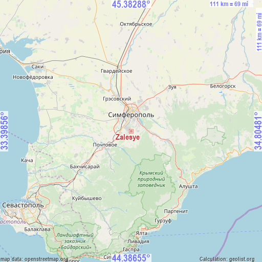
44° 53' 12.732" North, 34° 6' 6.048" East
| Map corner | latitude | longitude |
|---|---|---|
| Upper-left | 45.38288°, | 33.39856° |
| Center: | 44.88687°, | 34.10168° |
| Lower-right: | 44.38655°, | 34.80481° |
| Map W x H: | 110.8×110.8 km | = 68.8×68.8mi |
| max Lat: | 52.18903° ⇑93.5% North |
| Zalesye: | 44.88687° |
| min Lat: | ⇓6.5% South 44.39214° |
| min Long | Zalesye | max Long |
| 22.20555° | 34.10168° | 40.13222° |
| W 65.5%⇐ | ⇒34.5% E |
Elevation
Elevation of Zalesye is 422 m = 1385 ft, and this is 266.2 m = 873 ft above average elevation for this country.
| Max E: |
886 m = 2907 ft | 3.2% |
| Zalesye | 422 m 1385 ft | |
| Avg. | 155.8 m = 511 ft | |
Min E: |
-3 m = -10 ft | 96.8% |
See also: Ukraine elevation on elevation.city.
Geographical zone
Zalesye is located in North temperate zone (between Tropic of Cancer and the Arctic Circle). Distance of this Northern Tropic circle is 2385 km =1482 mi to South.| Distance of | km | miles | from Zalesye |
|---|---|---|---|
| North Pole | 5016.1 | 3116.9 | to North |
| Arctic Circle | 2410.2 | 1497.6 | to North |
| Tropic Cancer | 2385 | 1482 | to South |
| Equator | 4991 | 3101.3 | to South |


Nearby cities:
15 places around Zalesye: (largest is in red/bold)
• Andrusovo
6.1 km =3.8 mi,  85°
85°
• Chisten’koye
4.3 km =2.7 mi,  262°
262°
• Dubki
8.2 km =5.1 mi,  311°
311°
• Fontany
2.5 km =1.6 mi,  296°
296°
• Kashtanovoye
7 km =4.3 mi,  208°
208°
• Kizilovoye
8.8 km =5.5 mi, 211°
• Konstantinovka
3.8 km =2.4 mi,  157°
157°
• Levadki
5 km =3.1 mi,  248°
248°
• Lozovoye
5.4 km =3.4 mi,  66°
66°
• Partizanskoye
6.1 km =3.8 mi,  192°
192°
• Perovo
5.5 km =3.4 mi,  320°
320°
• Pionerskoye
7.9 km =4.9 mi, 94°
• Simferopol
7.9 km =4.9 mi,  5°
5°
• Trekhprudnoye
6.2 km =3.9 mi,  283°
283°
• Ukrainka
3 km =1.9 mi, 89°
Sources, notices
• [Note1] Compared only with cities in Ukraine existing in our database
• [Src1] Map data: © OpenStreetMap contributors (CC-BY-SA)
• [Src2] Other city data from geonames.org with taken over terms of usage.
• [Src3] Geographical zone / Annual Mean Temperature by Robert A. Rohde @ Wikipedia
