Vol’noye geodata
Vol’noye (Republic of Crimea) is a seat of a third-order administrative division; located in Ukraine in Europe/Simferopol (GMT+3) time zone. With population of 1,982 people, there are 1115 cities with bigger population in this country. Compared to other cities in Ukraine, 75.9% of cities are located further ↑North; 69.5% of cities are located further ←West and 80.6% of cities have higher elevation than Vol’noye. Note1
Administrative division(s):
- Level 1: Republic of Crimea
- Level 2: Dzhankoyskiy rayon
- Level 3: Vol'novskoye sel'skoye poselenye


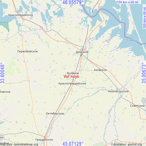
Vol’noye GPS coordinates[2]
45° 33' 56.52" North, 34° 18' 12.96" East
| Map corner | latitude | longitude |
|---|---|---|
| Upper-left | 46.05579°, | 33.60048° |
| Center: | 45.5657°, | 34.3036° |
| Lower-right: | 45.07129°, | 35.00673° |
| Map W x H: | 109.5×109.5 km | = 68×68mi |
| max Lat: | 52.18903° ⇑75.9% North |
| Vol’noye: | 45.5657° |
| min Lat: | ⇓24.1% South 44.39214° |
| min Long | Vol’noye | max Long |
| 22.20555° | 34.3036° | 40.13222° |
| W 69.5%⇐ | ⇒30.5% E |
Elevation
Elevation of Vol’noye is 41 m = 135 ft, and this is 114.8 m = 377 ft below average elevation for this country.
| Max E: |
886 m = 2907 ft | 80.6% |
| Avg. | 155.8 m = 511 ft | |
| Vol’noye | 41 m = 135 ft | |
Min E: |
-3 m = -10 ft | 19.4% |
See also: Ukraine elevation on elevation.city.
Geographical zone
Vol’noye is located in North temperate zone (between Tropic of Cancer and the Arctic Circle). Distance of this North polar circle is 2334.7 km =1450.7 mi to North.| Distance of | km | miles | from Vol’noye |
|---|---|---|---|
| North Pole | 4940.6 | 3069.9 | to North |
| Arctic Circle | 2334.7 | 1450.7 | to North |
| Tropic Cancer | 2460.5 | 1528.9 | to South |
| Equator | 5066.4 | 3148.1 | to South |


Nearby cities:
15 places around Vol’noye: (largest is in red/bold)
• Blizhnegorodskoye
10.3 km =6.4 mi,  35°
35°
• Blizhneye
4.8 km =3 mi,  184°
184°
• Kalinino
7.3 km =4.5 mi,  296°
296°
• Klepinino
10.3 km =6.4 mi,  245°
245°
• Kommunary
6.6 km =4.1 mi, 252°
• Krasnogvardeyskoye
7 km =4.3 mi, 181°
• Novoestoniya
8.7 km =5.4 mi,  212°
212°
• Petrovka
7.6 km =4.7 mi,  189°
189°
• Pushkino
3.3 km =2.1 mi, 176°
• Roshchino
7.7 km =4.8 mi,  50°
50°
• Rysakovo
9.8 km =6.1 mi,  10°
10°
• Shcherbakovo
9.9 km =6.2 mi,  158°
158°
• Vidnoye
7.5 km =4.7 mi, 159°
• Voskhod
9.4 km =5.8 mi,  131°
131°
• Yarkoye Pole
5.4 km =3.4 mi, 12°
Sources, notices
• [Note1] Compared only with cities in Ukraine existing in our database
• [Src1] Map data: © OpenStreetMap contributors (CC-BY-SA)
• [Src2] Other city data from geonames.org with taken over terms of usage.
• [Src3] Geographical zone / Annual Mean Temperature by Robert A. Rohde @ Wikipedia
