Zhelyabovka geodata
Zhelyabovka (Republic of Crimea) is a seat of a third-order administrative division; located in Ukraine in Europe/Simferopol (GMT+3) time zone. With population of 2,669 people, there are 1005 cities with bigger population in this country. Compared to other cities in Ukraine, 79.8% of cities are located further ↑North; 77.2% of cities are located further ←West and 84.8% of cities have higher elevation than Zhelyabovka. Note1
Administrative division(s):
- Level 1: Republic of Crimea
- Level 2: Nizhnegorskiy rayon
- Level 3: Zhelyabovskoye sel'skoye poselenye


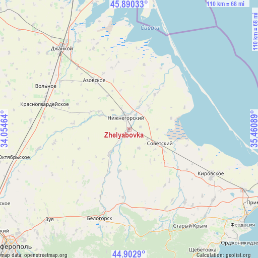
Zhelyabovka GPS coordinates[2]
45° 23' 55.572" North, 34° 45' 27.936" East
| Map corner | latitude | longitude |
|---|---|---|
| Upper-left | 45.89033°, | 34.05464° |
| Center: | 45.39877°, | 34.75776° |
| Lower-right: | 44.9029°, | 35.46089° |
| Map W x H: | 109.8×109.8 km | = 68.2×68.2mi |
| max Lat: | 52.18903° ⇑79.8% North |
| Zhelyabovka: | 45.39877° |
| min Lat: | ⇓20.2% South 44.39214° |
| min Long | Zhelyabovka | max Long |
| 22.20555° | 34.75776° | 40.13222° |
| W 77.2%⇐ | ⇒22.8% E |
Elevation
Elevation of Zhelyabovka is 30 m = 98 ft, and this is 125.8 m = 413 ft below average elevation for this country.
| Max E: |
886 m = 2907 ft | 84.8% |
| Avg. | 155.8 m = 511 ft | |
| Zhelyabovka | 30 m = 98 ft | |
Min E: |
-3 m = -10 ft | 15.2% |
See also: Ukraine elevation on elevation.city.
Geographical zone
Zhelyabovka is located in North temperate zone (between Tropic of Cancer and the Arctic Circle). Distance of this North polar circle is 2353.3 km =1462.3 mi to North.| Distance of | km | miles | from Zhelyabovka |
|---|---|---|---|
| North Pole | 4959.2 | 3081.5 | to North |
| Arctic Circle | 2353.3 | 1462.3 | to North |
| Tropic Cancer | 2442 | 1517.4 | to South |
| Equator | 5047.9 | 3136.6 | to South |


Nearby cities:
15 places around Zhelyabovka: (largest is in red/bold)
• Chernozemnoye
5 km =3.1 mi,  77°
77°
• Ivanovka
4 km =2.5 mi,  227°
227°
• Listvennoye
10 km =6.2 mi,  24°
24°
• Lomonosovo
5.8 km =3.6 mi,  273°
273°
• Mitrofanovka
8.5 km =5.3 mi,  313°
313°
• Nizhnegorskiy
5.7 km =3.5 mi,  344°
344°
• Novoivanovka
7.3 km =4.5 mi,  25°
25°
• Plodovoye
6.4 km =4 mi,  332°
332°
• Razdol’noye
8.6 km =5.3 mi,  118°
118°
• Razlivy
7.5 km =4.7 mi, 336°
• Semennoye
6.6 km =4.1 mi,  2°
2°
• Uvarovka
6.3 km =3.9 mi, 22°
• Zarech’ye
5.5 km =3.4 mi,  221°
221°
• Zavetnoye
8.9 km =5.5 mi,  153°
153°
• Zelyonoye
7.6 km =4.7 mi,  345°
345°
Sources, notices
• [Note1] Compared only with cities in Ukraine existing in our database
• [Src1] Map data: © OpenStreetMap contributors (CC-BY-SA)
• [Src2] Other city data from geonames.org with taken over terms of usage.
• [Src3] Geographical zone / Annual Mean Temperature by Robert A. Rohde @ Wikipedia
