Mitrofanovka geodata
Mitrofanovka (Republic of Crimea) is a seat of a third-order administrative division; located in Ukraine in Europe/Simferopol (GMT+3) time zone. With population of 1,226 people, there are 1287 cities with bigger population in this country. Compared to other cities in Ukraine, 78.4% of cities are located further ↑North; 75.9% of cities are located further ←West and 86.4% of cities have higher elevation than Mitrofanovka. Note1
Administrative division(s):
- Level 1: Republic of Crimea
- Level 2: Nizhnegorskiy rayon
- Level 3: Mitrofanovskoye sel'skoye poselenye


Mitrofanovka GPS coordinates[2]
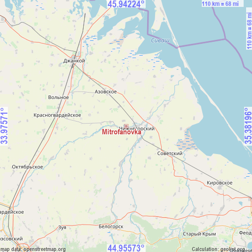
45° 27' 4.104" North, 34° 40' 43.788" East
| Map corner | latitude | longitude |
|---|---|---|
| Upper-left | 45.94224°, | 33.97571° |
| Center: | 45.45114°, | 34.67883° |
| Lower-right: | 44.95573°, | 35.38196° |
| Map W x H: | 109.7×109.7 km | = 68.2×68.2mi |
| max Lat: | 52.18903° ⇑78.4% North |
| Mitrofanovka: | 45.45114° |
| min Lat: | ⇓21.6% South 44.39214° |
| min Long | Mitrofanovka | max Long |
| 22.20555° | 34.67883° | 40.13222° |
| W 75.9%⇐ | ⇒24.1% E |
Elevation
Elevation of Mitrofanovka is 26 m = 85 ft, and this is 129.8 m = 426 ft below average elevation for this country.
| Max E: |
886 m = 2907 ft | 86.4% |
| Avg. | 155.8 m = 511 ft | |
| Mitrofanovka | 26 m = 85 ft | |
Min E: |
-3 m = -10 ft | 13.6% |
See also: Ukraine elevation on elevation.city.
Geographical zone
Mitrofanovka is located in North temperate zone (between Tropic of Cancer and the Arctic Circle). Distance of this North polar circle is 2347.5 km =1458.7 mi to North.| Distance of | km | miles | from Mitrofanovka |
|---|---|---|---|
| North Pole | 4953.4 | 3077.9 | to North |
| Arctic Circle | 2347.5 | 1458.7 | to North |
| Tropic Cancer | 2447.8 | 1521 | to South |
| Equator | 5053.7 | 3140.2 | to South |


Nearby cities:
15 places around Mitrofanovka: (largest is in red/bold)
• Ivanovka
9.1 km =5.7 mi,  159°
159°
• Lomonosovo
5.5 km =3.4 mi,  175°
175°
• Mikhaylovka
9.1 km =5.7 mi,  340°
340°
• Muskatnoye
10.7 km =6.6 mi,  278°
278°
• Nizhnegorskiy
4.7 km =2.9 mi,  94°
94°
• Novogrigoryevka
5.9 km =3.7 mi,  270°
270°
• Novoivanovka
9.4 km =5.8 mi, 85°
• Plodovoye
3.2 km =2 mi, 92°
• Razlivy
3.4 km =2.1 mi,  71°
71°
• Semennoye
6.5 km =4 mi,  83°
83°
• Uvarovka
8.5 km =5.3 mi, 90°
• Vladislavovka
7.1 km =4.4 mi,  285°
285°
• Zarech’ye
10.2 km =6.3 mi,  165°
165°
• Zelyonoye
4.5 km =2.8 mi, 69°
• Zhelyabovka
8.5 km =5.3 mi,  133°
133°
Sources, notices
• [Note1] Compared only with cities in Ukraine existing in our database
• [Src1] Map data: © OpenStreetMap contributors (CC-BY-SA)
• [Src2] Other city data from geonames.org with taken over terms of usage.
• [Src3] Geographical zone / Annual Mean Temperature by Robert A. Rohde @ Wikipedia
