Vinogradovo geodata
Vinogradovo (Republic of Crimea) is a seat of a third-order administrative division; located in Ukraine in Europe/Simferopol (GMT+3) time zone. With population of 881 people, there are 1444 cities with bigger population in this country. Compared to other cities in Ukraine, 79.8% of cities are located further ↑North; 54.5% of cities are located further ←West and 66.9% of cities have higher elevation than Vinogradovo. Note1
Administrative division(s):
- Level 1: Republic of Crimea
- Level 2: Sakskiy rayon
- Level 3: Vinogradovskoye sel'skoye poselenye


Vinogradovo GPS coordinates[2]
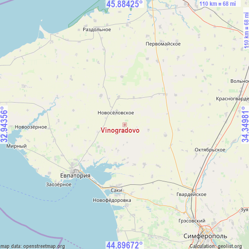
45° 23' 33.504" North, 33° 38' 48.048" East
| Map corner | latitude | longitude |
|---|---|---|
| Upper-left | 45.88425°, | 32.94356° |
| Center: | 45.39264°, | 33.64668° |
| Lower-right: | 44.89672°, | 34.34981° |
| Map W x H: | 109.8×109.8 km | = 68.2×68.2mi |
| max Lat: | 52.18903° ⇑79.8% North |
| Vinogradovo: | 45.39264° |
| min Lat: | ⇓20.2% South 44.39214° |
| min Long | Vinogradovo | max Long |
| 22.20555° | 33.64668° | 40.13222° |
| W 54.5%⇐ | ⇒45.5% E |
Elevation
Elevation of Vinogradovo is 84 m = 276 ft, and this is 71.8 m = 236 ft below average elevation for this country.
| Max E: |
886 m = 2907 ft | 66.9% |
| Avg. | 155.8 m = 511 ft | |
| Vinogradovo | 84 m = 276 ft | |
Min E: |
-3 m = -10 ft | 33.1% |
See also: Ukraine elevation on elevation.city.
Geographical zone
Vinogradovo is located in North temperate zone (between Tropic of Cancer and the Arctic Circle). Distance of this North polar circle is 2354 km =1462.7 mi to North.| Distance of | km | miles | from Vinogradovo |
|---|---|---|---|
| North Pole | 4959.9 | 3081.9 | to North |
| Arctic Circle | 2354 | 1462.7 | to North |
| Tropic Cancer | 2441.3 | 1517 | to South |
| Equator | 5047.2 | 3136.2 | to South |


Nearby cities:
15 places around Vinogradovo: (largest is in red/bold)
• Dolinka
16.8 km =10.4 mi,  175°
175°
• Glinka
14.9 km =9.3 mi,  216°
216°
• Il’inka
10.8 km =6.7 mi,  102°
102°
• Kar’yernoye
12 km =7.5 mi,  193°
193°
• Kol’tsovo
17 km =10.6 mi,  244°
244°
• Kormovoye
12.2 km =7.6 mi,  347°
347°
• Mityayevo
18.1 km =11.2 mi,  166°
166°
• Novoselovskoye
6.7 km =4.2 mi,  325°
325°
• Okhotnikovo
17.5 km =10.9 mi, 193°
• Orlyanka
18.5 km =11.5 mi,  200°
200°
• Stolbovoye
12.2 km =7.6 mi,  254°
254°
• Susanino
12.5 km =7.8 mi,  18°
18°
• Veresayevo
15 km =9.3 mi,  229°
229°
• Zhuravli
15.6 km =9.7 mi, 181°
• Zimino
16.5 km =10.3 mi,  321°
321°
Sources, notices
• [Note1] Compared only with cities in Ukraine existing in our database
• [Src1] Map data: © OpenStreetMap contributors (CC-BY-SA)
• [Src2] Other city data from geonames.org with taken over terms of usage.
• [Src3] Geographical zone / Annual Mean Temperature by Robert A. Rohde @ Wikipedia
