Veresayevo geodata
Veresayevo (Republic of Crimea) is a seat of a third-order administrative division; located in Ukraine in Europe/Simferopol (GMT+3) time zone. With population of 1,708 people, there are 1167 cities with bigger population in this country. Compared to other cities in Ukraine, 82.5% of cities are located further ↑North; 51.7% of cities are located further ←West and 80.6% of cities have higher elevation than Veresayevo. Note1
Administrative division(s):
- Level 1: Republic of Crimea
- Level 2: Sakskiy rayon
- Level 3: Veresaevskoye sel'skoye poselenye


Veresayevo GPS coordinates[2]
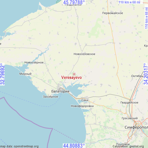
45° 18' 19.836" North, 33° 30' 0.144" East
| Map corner | latitude | longitude |
|---|---|---|
| Upper-left | 45.79788°, | 32.79692° |
| Center: | 45.30551°, | 33.50004° |
| Lower-right: | 44.80883°, | 34.20317° |
| Map W x H: | 110×110 km | = 68.4×68.4mi |
| max Lat: | 52.18903° ⇑82.5% North |
| Veresayevo: | 45.30551° |
| min Lat: | ⇓17.5% South 44.39214° |
| min Long | Veresayevo | max Long |
| 22.20555° | 33.50004° | 40.13222° |
| W 51.7%⇐ | ⇒48.3% E |
Elevation
Elevation of Veresayevo is 41 m = 135 ft, and this is 114.8 m = 377 ft below average elevation for this country.
| Max E: |
886 m = 2907 ft | 80.6% |
| Avg. | 155.8 m = 511 ft | |
| Veresayevo | 41 m = 135 ft | |
Min E: |
-3 m = -10 ft | 19.4% |
See also: Ukraine elevation on elevation.city.
Geographical zone
Veresayevo is located in North temperate zone (between Tropic of Cancer and the Arctic Circle). Distance of this North polar circle is 2363.7 km =1468.7 mi to North.| Distance of | km | miles | from Veresayevo |
|---|---|---|---|
| North Pole | 4969.6 | 3088 | to North |
| Arctic Circle | 2363.7 | 1468.7 | to North |
| Tropic Cancer | 2431.6 | 1510.9 | to South |
| Equator | 5037.5 | 3130.2 | to South |


Nearby cities:
15 places around Veresayevo: (largest is in red/bold)
• Dobrushino
13 km =8.1 mi,  306°
306°
• Dolinka
14.6 km =9.1 mi,  118°
118°
• Glinka
3.6 km =2.2 mi,  130°
130°
• Kamenolomnya
9.1 km =5.7 mi,  225°
225°
• Kar’yernoye
8.8 km =5.5 mi,  102°
102°
• Koloski
16.6 km =10.3 mi,  256°
256°
• Kol’tsovo
4.7 km =2.9 mi,  302°
302°
• Novoselovskoye
17.1 km =10.6 mi,  26°
26°
• Okhotnikovo
10.4 km =6.5 mi, 134°
• Orlyanka
9.2 km =5.7 mi,  146°
146°
• Stolbovoye
6.4 km =4 mi,  357°
357°
• Suvorovskoye
11.7 km =7.3 mi,  239°
239°
• Vinogradovo
15 km =9.3 mi,  49°
49°
• Yevpatoriya
15.6 km =9.7 mi,  221°
221°
• Zhuravli
12.5 km =7.8 mi, 118°
Sources, notices
• [Note1] Compared only with cities in Ukraine existing in our database
• [Src1] Map data: © OpenStreetMap contributors (CC-BY-SA)
• [Src2] Other city data from geonames.org with taken over terms of usage.
• [Src3] Geographical zone / Annual Mean Temperature by Robert A. Rohde @ Wikipedia
