Il’inka geodata
Il’inka (Republic of Crimea) is a populated place; located in Ukraine in Europe/Simferopol (GMT+3) time zone. With population of 816 people, there are 1477 cities with bigger population in this country. Compared to other cities in Ukraine, 80.7% of cities are located further ↑North; 57.3% of cities are located further ←West and 69.8% of cities have higher elevation than Il’inka. Note1
Administrative division(s):
- Level 1: Republic of Crimea
- Level 2: Sakskiy rayon
- Level 3: Sizovskoye sel'skoye poselenye


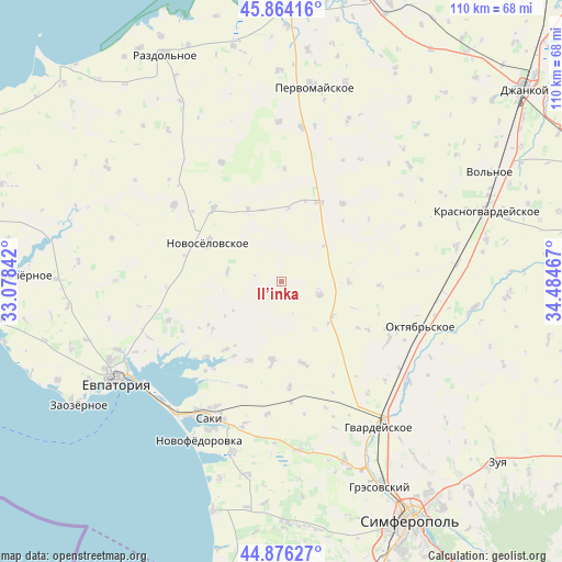
Il’inka GPS coordinates[2]
45° 22' 20.532" North, 33° 46' 53.544" East
| Map corner | latitude | longitude |
|---|---|---|
| Upper-left | 45.86416°, | 33.07842° |
| Center: | 45.37237°, | 33.78154° |
| Lower-right: | 44.87627°, | 34.48467° |
| Map W x H: | 109.8×109.8 km | = 68.2×68.2mi |
| max Lat: | 52.18903° ⇑80.7% North |
| Il’inka: | 45.37237° |
| min Lat: | ⇓19.3% South 44.39214° |
| min Long | Il’inka | max Long |
| 22.20555° | 33.78154° | 40.13222° |
| W 57.3%⇐ | ⇒42.7% E |
Elevation
Elevation of Il’inka is 76 m = 249 ft, and this is 79.8 m = 262 ft below average elevation for this country.
| Max E: |
886 m = 2907 ft | 69.8% |
| Avg. | 155.8 m = 511 ft | |
| Il’inka | 76 m = 249 ft | |
Min E: |
-3 m = -10 ft | 30.2% |
See also: Ukraine elevation on elevation.city.
Geographical zone
Il’inka is located in North temperate zone (between Tropic of Cancer and the Arctic Circle). Distance of this North polar circle is 2356.2 km =1464.1 mi to North.| Distance of | km | miles | from Il’inka |
|---|---|---|---|
| North Pole | 4962.1 | 3083.3 | to North |
| Arctic Circle | 2356.2 | 1464.1 | to North |
| Tropic Cancer | 2439 | 1515.5 | to South |
| Equator | 5044.9 | 3134.8 | to South |


Nearby cities:
15 places around Il’inka: (largest is in red/bold)
• Dolinka
17.1 km =10.6 mi,  212°
212°
• Kar’yernoye
16.4 km =10.2 mi,  235°
235°
• Kotel’nikovo
19.1 km =11.9 mi,  92°
92°
• Krayneye
16.3 km =10.1 mi,  165°
165°
• Mityayevo
16.6 km =10.3 mi,  202°
202°
• Novoselovskoye
16.3 km =10.1 mi,  298°
298°
• Sizovka
7.9 km =4.9 mi,  109°
109°
• Stakhanovka
13.1 km =8.1 mi, 90°
• Susanino
15.5 km =9.6 mi,  335°
335°
• Timoshenko
17.6 km =10.9 mi,  121°
121°
• Trudovoye
15.1 km =9.4 mi,  186°
186°
• Vinogradovo
10.8 km =6.7 mi,  282°
282°
• Voykovo
17.2 km =10.7 mi,  25°
25°
• Zernovoye
11.4 km =7.1 mi,  145°
145°
• Zhuravli
17.3 km =10.7 mi,  219°
219°
Sources, notices
• [Note1] Compared only with cities in Ukraine existing in our database
• [Src1] Map data: © OpenStreetMap contributors (CC-BY-SA)
• [Src2] Other city data from geonames.org with taken over terms of usage.
• [Src3] Geographical zone / Annual Mean Temperature by Robert A. Rohde @ Wikipedia
