Pervomayskoye geodata
Pervomayskoye (Republic of Crimea) is a seat of a third-order administrative division; located in Ukraine in Europe/Simferopol (GMT+3) time zone. With population of 2,247 people, there are 1068 cities with bigger population in this country. Compared to other cities in Ukraine, 88.1% of cities are located further ↑North; 64.6% of cities are located further ←West and 50.9% of cities have lower elevation than Pervomayskoye. Note1
Administrative division(s):
- Level 1: Republic of Crimea
- Level 2: Simferopol Raion
- Level 3: Pervomayskoye sel'skoye poselenye


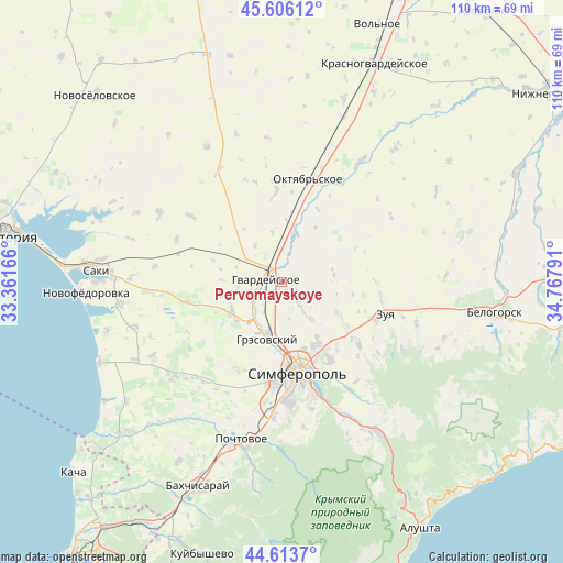
Pervomayskoye GPS coordinates[2]
45° 6' 43.452" North, 34° 3' 53.208" East
| Map corner | latitude | longitude |
|---|---|---|
| Upper-left | 45.60612°, | 33.36166° |
| Center: | 45.11207°, | 34.06478° |
| Lower-right: | 44.6137°, | 34.76791° |
| Map W x H: | 110.3×110.3 km | = 68.5×68.5mi |
| max Lat: | 52.18903° ⇑88.1% North |
| Pervomayskoye: | 45.11207° |
| min Lat: | ⇓11.9% South 44.39214° |
| min Long | Pervomayskoye | max Long |
| 22.20555° | 34.06478° | 40.13222° |
| W 64.6%⇐ | ⇒35.4% E |
Elevation
Elevation of Pervomayskoye is 139 m = 456 ft, and this is 16.8 m = 55 ft below average elevation for this country.
| Max E: |
886 m = 2907 ft | 49.1% |
| Avg. | 155.8 m = 511 ft | |
| Pervomayskoye | 139 m = 456 ft | |
Min E: |
-3 m = -10 ft | 50.9% |
See also: Ukraine elevation on elevation.city.
Geographical zone
Pervomayskoye is located in North temperate zone (between Tropic of Cancer and the Arctic Circle). Distance of this North polar circle is 2385.2 km =1482.1 mi to North.| Distance of | km | miles | from Pervomayskoye |
|---|---|---|---|
| North Pole | 4991.1 | 3101.3 | to North |
| Arctic Circle | 2385.2 | 1482.1 | to North |
| Tropic Cancer | 2410.1 | 1497.6 | to South |
| Equator | 5016 | 3116.8 | to South |


Nearby cities:
15 places around Pervomayskoye: (largest is in red/bold)
• Agrarnoye
10.7 km =6.6 mi,  183°
183°
• Chaykino
3.7 km =2.3 mi,  152°
152°
• Hvardiiske
3.4 km =2.1 mi,  279°
279°
• Klyonovka
10.3 km =6.4 mi,  82°
82°
• Krasna Zor'ka
3.1 km =1.9 mi,  322°
322°
• Krasnoye
3.9 km =2.4 mi,  36°
36°
• Malen’koye
6.5 km =4 mi,  231°
231°
• Novoandreyevka
9.9 km =6.2 mi,  13°
13°
• Shirokoye
9.9 km =6.2 mi,  353°
353°
• Sofiivka
5.7 km =3.5 mi,  244°
244°
• Solnechnoye
7.3 km =4.5 mi,  168°
168°
• Sovkhoznoye
10 km =6.2 mi,  205°
205°
• Ukromnoye
9.1 km =5.7 mi, 212°
• Urozhaynoye
9.3 km =5.8 mi,  143°
143°
• Zhuravlyovka
9 km =5.6 mi, 323°
Sources, notices
• [Note1] Compared only with cities in Ukraine existing in our database
• [Src1] Map data: © OpenStreetMap contributors (CC-BY-SA)
• [Src2] Other city data from geonames.org with taken over terms of usage.
• [Src3] Geographical zone / Annual Mean Temperature by Robert A. Rohde @ Wikipedia
