Partyzany geodata
Partyzany (Kherson) is a populated place; located in Ukraine in Europe/Kiev (GMT+3) time zone. With population of 3,738 people, there are 794 cities with bigger population in this country. Compared to other cities in Ukraine, 67.9% of cities are located further ↑North; 77.2% of cities are located further ←West and 87.1% of cities have higher elevation than Partyzany. Note1


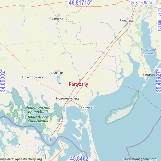
Partyzany GPS coordinates[2]
46° 20' 1.788" North, 34° 45' 11.304" East
| Map corner | latitude | longitude |
|---|---|---|
| Upper-left | 46.81715°, | 34.05002° |
| Center: | 46.33383°, | 34.75314° |
| Lower-right: | 45.8462°, | 35.45627° |
| Map W x H: | 108×108 km | = 67.1×67.1mi |
| max Lat: | 52.18903° ⇑67.9% North |
| Partyzany: | 46.33383° |
| min Lat: | ⇓32.1% South 44.39214° |
| min Long | Partyzany | max Long |
| 22.20555° | 34.75314° | 40.13222° |
| W 77.2%⇐ | ⇒22.8% E |
Elevation
Elevation of Partyzany is 24 m = 79 ft, and this is 131.8 m = 432 ft below average elevation for this country.
| Max E: |
886 m = 2907 ft | 87.1% |
| Avg. | 155.8 m = 511 ft | |
| Partyzany | 24 m = 79 ft | |
Min E: |
-3 m = -10 ft | 12.9% |
See also: Ukraine elevation on elevation.city.
Geographical zone
Partyzany is located in North temperate zone (between Tropic of Cancer and the Arctic Circle). Distance of this North polar circle is 2249.3 km =1397.6 mi to North.| Distance of | km | miles | from Partyzany |
|---|---|---|---|
| North Pole | 4855.2 | 3016.9 | to North |
| Arctic Circle | 2249.3 | 1397.6 | to North |
| Tropic Cancer | 2545.9 | 1581.9 | to South |
| Equator | 5151.8 | 3201.2 | to South |


Nearby cities:
15 places around Partyzany: (largest is in red/bold)
• Chaykino
59.4 km =36.9 mi,  191°
191°
• Heniches’k
18 km =11.2 mi,  167°
167°
• Ivanivka
45.7 km =28.4 mi,  340°
340°
• Kyrylivka
47.4 km =29.5 mi,  84°
84°
• Martynovka
60.8 km =37.8 mi,  212°
212°
• Medvedevka
52.3 km =32.5 mi,  196°
196°
• Novooleksiyivka
14.9 km =9.3 mi,  215°
215°
• Novotroyits’ke
32.4 km =20.1 mi,  274°
274°
• Nyzhni Sirohozy
63.9 km =39.7 mi,  333°
333°
• Solyonoye Ozero
55.5 km =34.5 mi, 205°
• Turgenevo
51.3 km =31.9 mi, 194°
• Yakymivka
51.2 km =31.8 mi,  37°
37°
• Yasnopolyanskoye
53.5 km =33.2 mi, 215°
• Yermakovo
57.2 km =35.5 mi, 201°
• Zavet-Leninskiy
59.4 km =36.9 mi, 208°
Sources, notices
• [Note1] Compared only with cities in Ukraine existing in our database
• [Src1] Map data: © OpenStreetMap contributors (CC-BY-SA)
• [Src2] Other city data from geonames.org with taken over terms of usage.
• [Src3] Geographical zone / Annual Mean Temperature by Robert A. Rohde @ Wikipedia
