Okunevka geodata
Okunevka (Republic of Crimea) is a seat of a third-order administrative division; located in Ukraine in Europe/Simferopol (GMT+3) time zone. With population of 522 people, there are 1639 cities with bigger population in this country. Compared to other cities in Ukraine, 80.8% of cities are located further ↑North; 53.8% of cities are located further →East and 90.9% of cities have higher elevation than Okunevka. Note1
Administrative division(s):
- Level 1: Republic of Crimea
- Level 2: Chernomorskiy rayon
- Level 3: Okunevskoye sel'skoye poselenye


Okunevka GPS coordinates[2]
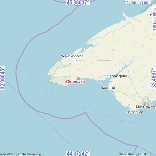
45° 22' 6.78" North, 32° 45' 48.852" East
| Map corner | latitude | longitude |
|---|---|---|
| Upper-left | 45.86037°, | 32.06045° |
| Center: | 45.36855°, | 32.76357° |
| Lower-right: | 44.87242°, | 33.4667° |
| Map W x H: | 109.8×109.8 km | = 68.2×68.2mi |
| max Lat: | 52.18903° ⇑80.8% North |
| Okunevka: | 45.36855° |
| min Lat: | ⇓19.2% South 44.39214° |
| min Long | Okunevka | max Long |
| 22.20555° | 32.76357° | 40.13222° |
| W 46.2%⇐ | ⇒53.8% E |
Elevation
Elevation of Okunevka is 18 m = 59 ft, and this is 137.8 m = 452 ft below average elevation for this country.
| Max E: |
886 m = 2907 ft | 90.9% |
| Avg. | 155.8 m = 511 ft | |
| Okunevka | 18 m = 59 ft | |
Min E: |
-3 m = -10 ft | 9.1% |
See also: Ukraine elevation on elevation.city.
Geographical zone
Okunevka is located in North temperate zone (between Tropic of Cancer and the Arctic Circle). Distance of this North polar circle is 2356.7 km =1464.4 mi to North.| Distance of | km | miles | from Okunevka |
|---|---|---|---|
| North Pole | 4962.6 | 3083.6 | to North |
| Arctic Circle | 2356.7 | 1464.4 | to North |
| Tropic Cancer | 2438.6 | 1515.3 | to South |
| Equator | 5044.5 | 3134.5 | to South |


Nearby cities:
15 places around Okunevka: (largest is in red/bold)
• Chernomorskoye
16.2 km =10.1 mi,  341°
341°
• Kalinovka
14.3 km =8.9 mi, 335°
• Kirovskoye
31.4 km =19.5 mi,  51°
51°
• Krasnaya Polyana
18.6 km =11.6 mi, 47°
• Krasnosel’skoye
8.3 km =5.2 mi,  306°
306°
• Medvedevo
18.9 km =11.7 mi,  84°
84°
• Mezhvodnoye
25.2 km =15.7 mi,  14°
14°
• Mirny
22.3 km =13.9 mi,  107°
107°
• Novoivanovka
27.6 km =17.1 mi,  71°
71°
• Novoozyornoye
27.7 km =17.2 mi,  86°
86°
• Novosel’skoye
15.4 km =9.6 mi,  347°
347°
• Olenevka
18.1 km =11.2 mi,  275°
275°
• Shishkino
35.1 km =21.8 mi,  100°
100°
• Shtormovoye
27.7 km =17.2 mi, 114°
• Veselovka
35.2 km =21.9 mi, 88°
Sources, notices
• [Note1] Compared only with cities in Ukraine existing in our database
• [Src1] Map data: © OpenStreetMap contributors (CC-BY-SA)
• [Src2] Other city data from geonames.org with taken over terms of usage.
• [Src3] Geographical zone / Annual Mean Temperature by Robert A. Rohde @ Wikipedia
