Mezhvodnoye geodata
Mezhvodnoye (Republic of Crimea) is a seat of a third-order administrative division; located in Ukraine in Europe/Simferopol (GMT+3) time zone. With population of 2,087 people, there are 1090 cities with bigger population in this country. Compared to other cities in Ukraine, 75.4% of cities are located further ↑North; 53.3% of cities are located further →East and 95.3% of cities have higher elevation than Mezhvodnoye. Note1
Administrative division(s):
- Level 1: Republic of Crimea
- Level 2: Chernomorskiy rayon
- Level 3: Mezhvodnenskoye sel'skoye poselenye


Mezhvodnoye GPS coordinates[2]
45° 35' 15.036" North, 32° 50' 42.036" East
| Map corner | latitude | longitude |
|---|---|---|
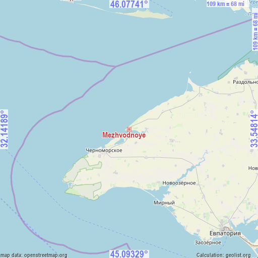
| Upper-left | 46.07741°, | 32.14189° |
| Center: | 45.58751°, | 32.84501° |
| Lower-right: | 45.09329°, | 33.54814° |
| Map W x H: | 109.4×109.4 km | = 68×68mi |
| max Lat: | 52.18903° ⇑75.4% North |
| Mezhvodnoye: | 45.58751° |
| min Lat: | ⇓24.6% South 44.39214° |
| min Long | Mezhvodnoye | max Long |
| 22.20555° | 32.84501° | 40.13222° |
| W 46.7%⇐ | ⇒53.3% E |
Elevation
Elevation of Mezhvodnoye is 11 m = 36 ft, and this is 144.8 m = 475 ft below average elevation for this country.
| Max E: |
886 m = 2907 ft | 95.3% |
| Avg. | 155.8 m = 511 ft | |
| Mezhvodnoye | 11 m = 36 ft | |
Min E: |
-3 m = -10 ft | 4.7% |
See also: Ukraine elevation on elevation.city.
Geographical zone
Mezhvodnoye is located in North temperate zone (between Tropic of Cancer and the Arctic Circle). Distance of this North polar circle is 2332.3 km =1449.2 mi to North.| Distance of | km | miles | from Mezhvodnoye |
|---|---|---|---|
| North Pole | 4938.2 | 3068.5 | to North |
| Arctic Circle | 2332.3 | 1449.2 | to North |
| Tropic Cancer | 2462.9 | 1530.4 | to South |
| Equator | 5068.9 | 3149.7 | to South |


Nearby cities:
15 places around Mezhvodnoye: (largest is in red/bold)
• Chernomorskoye
14.6 km =9.1 mi,  231°
231°
• Dalekoye
20 km =12.4 mi,  66°
66°
• Kalinovka
16.8 km =10.4 mi, 227°
• Kirovskoye
18.7 km =11.6 mi,  104°
104°
• Krasnaya Polyana
13.7 km =8.5 mi,  148°
148°
• Krasnosel’skoye
23.3 km =14.5 mi,  213°
213°
• Krasnoyarskoye
34 km =21.1 mi,  105°
105°
• Medvedevo
25.6 km =15.9 mi, 151°
• Niva
32.8 km =20.4 mi,  91°
91°
• Novoivanovka
25 km =15.5 mi,  127°
127°
• Novoozyornoye
31.1 km =19.3 mi,  136°
136°
• Novosel’skoye
13.3 km =8.3 mi, 225°
• Okunevka
25.2 km =15.7 mi,  194°
194°
• Olenevka
33.3 km =20.7 mi, 226°
• Slavnoye
33.9 km =21.1 mi,  63°
63°
Sources, notices
• [Note1] Compared only with cities in Ukraine existing in our database
• [Src1] Map data: © OpenStreetMap contributors (CC-BY-SA)
• [Src2] Other city data from geonames.org with taken over terms of usage.
• [Src3] Geographical zone / Annual Mean Temperature by Robert A. Rohde @ Wikipedia
