Shishkino geodata
Shishkino (Republic of Crimea) is a populated place; located in Ukraine in Europe/Simferopol (GMT+3) time zone. With population of 528 people, there are 1635 cities with bigger population in this country. Compared to other cities in Ukraine, 82.2% of cities are located further ↑North; 51.4% of cities are located further →East and 77.6% of cities have higher elevation than Shishkino. Note1
Administrative division(s):
- Level 1: Republic of Crimea
- Level 2: Sakskiy rayon
- Level 3: Vorobyovskoye sel'skoye poselenye


Shishkino GPS coordinates[2]
45° 18' 43.02" North, 33° 12' 20.376" East
| Map corner | latitude | longitude |
|---|---|---|
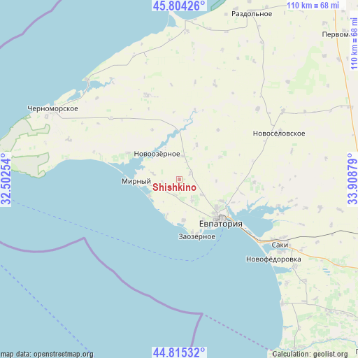
| Upper-left | 45.80426°, | 32.50254° |
| Center: | 45.31195°, | 33.20566° |
| Lower-right: | 44.81532°, | 33.90879° |
| Map W x H: | 110×110 km | = 68.4×68.4mi |
| max Lat: | 52.18903° ⇑82.2% North |
| Shishkino: | 45.31195° |
| min Lat: | ⇓17.8% South 44.39214° |
| min Long | Shishkino | max Long |
| 22.20555° | 33.20566° | 40.13222° |
| W 48.6%⇐ | ⇒51.4% E |
Elevation
Elevation of Shishkino is 52 m = 171 ft, and this is 103.8 m = 341 ft below average elevation for this country.
| Max E: |
886 m = 2907 ft | 77.6% |
| Avg. | 155.8 m = 511 ft | |
| Shishkino | 52 m = 171 ft | |
Min E: |
-3 m = -10 ft | 22.4% |
See also: Ukraine elevation on elevation.city.
Geographical zone
Shishkino is located in North temperate zone (between Tropic of Cancer and the Arctic Circle). Distance of this North polar circle is 2363 km =1468.3 mi to North.| Distance of | km | miles | from Shishkino |
|---|---|---|---|
| North Pole | 4968.8 | 3087.5 | to North |
| Arctic Circle | 2363 | 1468.3 | to North |
| Tropic Cancer | 2432.3 | 1511.4 | to South |
| Equator | 5038.2 | 3130.6 | to South |


Nearby cities:
15 places around Shishkino: (largest is in red/bold)
• Abrikosovka
4.7 km =2.9 mi,  193°
193°
• Dobrushino
14.3 km =8.9 mi,  60°
60°
• Koloski
8.4 km =5.2 mi,  124°
124°
• Mirny
13.4 km =8.3 mi,  268°
268°
• Molochnoye
12.6 km =7.8 mi,  174°
174°
• Natashino
11.9 km =7.4 mi,  26°
26°
• Novoivanovka
17.4 km =10.8 mi,  331°
331°
• Novoozyornoye
10.5 km =6.5 mi,  318°
318°
• Romashkino
7.3 km =4.5 mi,  147°
147°
• Shtormovoye
10.5 km =6.5 mi,  241°
241°
• Suvorovskoye
14.6 km =9.1 mi, 117°
• Uyutnoye
14.6 km =9.1 mi, 150°
• Veselovka
7.3 km =4.5 mi,  5°
5°
• Vitino
11.2 km =7 mi,  198°
198°
• Vorobyovo
3.7 km =2.3 mi, 59°
Sources, notices
• [Note1] Compared only with cities in Ukraine existing in our database
• [Src1] Map data: © OpenStreetMap contributors (CC-BY-SA)
• [Src2] Other city data from geonames.org with taken over terms of usage.
• [Src3] Geographical zone / Annual Mean Temperature by Robert A. Rohde @ Wikipedia
