Horbachevo-Mykhaylivka geodata
Horbachevo-Mykhaylivka (Donetsk) is a populated place; located in Ukraine in Europe/Kiev (GMT+3) time zone. With population of 797 people, there are 1485 cities with bigger population in this country. Compared to other cities in Ukraine, 58.1% of cities are located further ↑North; 94.4% of cities are located further ←West and 63.5% of cities have higher elevation than Horbachevo-Mykhaylivka. Note1


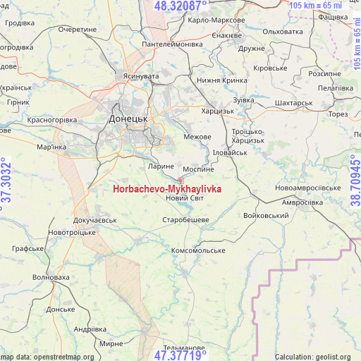
Horbachevo-Mykhaylivka GPS coordinates[2]
47° 51' 4.248" North, 38° 0' 22.752" East
| Map corner | latitude | longitude |
|---|---|---|
| Upper-left | 48.32087°, | 37.3032° |
| Center: | 47.85118°, | 38.00632° |
| Lower-right: | 47.37719°, | 38.70945° |
| Map W x H: | 104.9×104.9 km | = 65.2×65.2mi |
| max Lat: | 52.18903° ⇑58.1% North |
| Horbachevo-Mykhaylivka: | 47.85118° |
| min Lat: | ⇓41.9% South 44.39214° |
| min Long | Horbachevo-Mykh | max Long |
| 22.20555° | 38.00632° | 40.13222° |
| W 94.4%⇐ | ⇒5.6% E |
Elevation
Elevation of Horbachevo-Mykhaylivka is 95 m = 312 ft, and this is 60.8 m = 199 ft below average elevation for this country.
| Max E: |
886 m = 2907 ft | 63.5% |
| Avg. | 155.8 m = 511 ft | |
| Horbachevo-Mykhaylivka | 95 m = 312 ft | |
Min E: |
-3 m = -10 ft | 36.5% |
See also: Ukraine elevation on elevation.city.
Geographical zone
Horbachevo-Mykhaylivka is located in North temperate zone (between Tropic of Cancer and the Arctic Circle). Distance of this North polar circle is 2080.6 km =1292.8 mi to North.| Distance of | km | miles | from Horbachevo-Mykhaylivka |
|---|---|---|---|
| North Pole | 4686.5 | 2912.1 | to North |
| Arctic Circle | 2080.6 | 1292.8 | to North |
| Tropic Cancer | 2714.6 | 1686.8 | to South |
| Equator | 5320.6 | 3306.1 | to South |


Nearby cities:
15 places around Horbachevo-Mykhaylivka: (largest is in red/bold)
• Dokuchayevs’k
26.9 km =16.7 mi,  245°
245°
• Donetsk
24.4 km =15.2 mi,  321°
321°
• Ilovays’k
16.8 km =10.4 mi,  60°
60°
• Khartsyz’k
23.7 km =14.7 mi,  26°
26°
• Krinichnaya
30.9 km =19.2 mi,  2°
2°
• Kuteynykove
21.5 km =13.4 mi,  101°
101°
• Makiyivka
22.7 km =14.1 mi,  344°
344°
• Mospyne
6.2 km =3.9 mi,  44°
44°
• Novyy Svit
5.2 km =3.2 mi,  167°
167°
• P'yatypill'ya
19.6 km =12.2 mi,  20°
20°
• Shakhtne
25.3 km =15.7 mi,  54°
54°
• Shyroke
20.5 km =12.7 mi, 54°
• Starobesheve
11.4 km =7.1 mi, 170°
• Vysoke
11 km =6.8 mi, 20°
• Zuhres
26.2 km =16.3 mi, 47°
Sources, notices
• [Note1] Compared only with cities in Ukraine existing in our database
• [Src1] Map data: © OpenStreetMap contributors (CC-BY-SA)
• [Src2] Other city data from geonames.org with taken over terms of usage.
• [Src3] Geographical zone / Annual Mean Temperature by Robert A. Rohde @ Wikipedia
