Vass geodata
Vass (North Carolina) is a populated place; located in United States in America/New_York (GMT-4) time zone. With population of 749 people, there are 18212 cities with bigger population in this country. Compared to other cities in United States, 73.9% of cities are located further ↑North; 75.3% of cities are located further ←West and 70.9% of cities have higher elevation than Vass. Note1


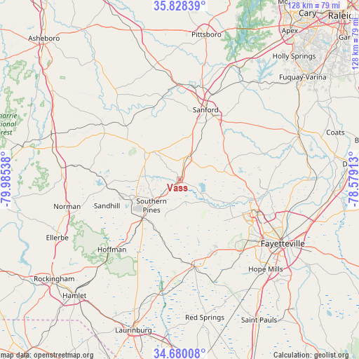
Vass GPS coordinates[2]
35° 15' 22.572" North, 79° 16' 56.1" West
| Map corner | latitude | longitude |
|---|---|---|
| Upper-left | 35.82839°, | -79.98538° |
| Center: | 35.25627°, | -79.28225° |
| Lower-right: | 34.68008°, | -78.57913° |
| Map W x H: | 127.7×127.7 km | = 79.3×79.3mi |
| max Lat: | 71.29058° ⇑73.9% North |
| Vass: | 35.25627° |
| min Lat: | ⇓26.1% South 19.06759° |
| min Long | Vass | max Long |
| -171.73463° | -79.28225° | -66.98998° |
| W 75.3%⇐ | ⇒24.7% E |
Elevation
Elevation of Vass is 95 m = 312 ft, and this is 199.8 m = 656 ft below average elevation for this country.
| Max E: |
3189 m = 10463 ft | 70.9% |
| Avg. | 294.8 m = 967 ft | |
| Vass | 95 m = 312 ft | |
Min E: |
-60 m = -197 ft | 29.1% |
See also: United States elevation on elevation.city.
Geographical zone
Vass is located in North temperate zone (between Tropic of Cancer and the Arctic Circle). Distance of this Northern Tropic circle is 1314.2 km =816.6 mi to South.| Distance of | km | miles | from Vass |
|---|---|---|---|
| North Pole | 6086.9 | 3782.2 | to North |
| Arctic Circle | 3481 | 2163 | to North |
| Tropic Cancer | 1314.2 | 816.6 | to South |
| Equator | 3920.1 | 2435.8 | to South |


Nearby cities:
15 places around Vass: (largest is in red/bold)
• Aberdeen
19.3 km =12 mi,  223°
223°
• Broadway
30.6 km =19 mi,  42°
42°
• Carthage
15.8 km =9.8 mi,  309°
309°
• Five Points
27.6 km =17.1 mi,  195°
195°
• Fort Bragg
28.3 km =17.6 mi,  117°
117°
• Foxfire
27.8 km =17.3 mi,  251°
251°
• Pinebluff
23.7 km =14.7 mi,  226°
226°
• Pinehurst
18.3 km =11.4 mi, 248°
• Sanford
26.5 km =16.5 mi,  20°
20°
• Seven Lakes
25.7 km =16 mi,  275°
275°
• Silver City
29.4 km =18.3 mi,  170°
170°
• Southern Pines
13.5 km =8.4 mi, 227°
• Spring Lake
29.8 km =18.5 mi,  109°
109°
• Taylortown
19.3 km =12 mi, 253°
• Whispering Pines
8.2 km =5.1 mi,  269°
269°
Sources, notices
• [Note1] Compared only with cities in United States existing in our database
• [Src1] Map data: © OpenStreetMap contributors (CC-BY-SA)
• [Src2] Other city data from geonames.org with taken over terms of usage.
• [Src3] Geographical zone / Annual Mean Temperature by Robert A. Rohde @ Wikipedia
