Samson geodata
Samson (Alabama) is a populated place; located in United States in America/Chicago (GMT-5) time zone. With population of 1,928 people, there are 12160 cities with bigger population in this country. Compared to other cities in United States, 90.5% of cities are located further ↑North; 52.8% of cities are located further ←West and 75.3% of cities have higher elevation than Samson. Note1


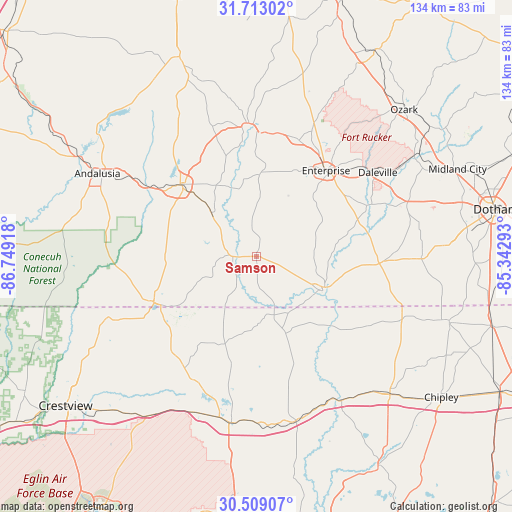
Samson GPS coordinates[2]
31° 6' 46.62" North, 86° 2' 45.78" West
| Map corner | latitude | longitude |
|---|---|---|
| Upper-left | 31.71302°, | -86.74918° |
| Center: | 31.11295°, | -86.04605° |
| Lower-right: | 30.50907°, | -85.34293° |
| Map W x H: | 133.9×133.9 km | = 83.2×83.2mi |
| max Lat: | 71.29058° ⇑90.5% North |
| Samson: | 31.11295° |
| min Lat: | ⇓9.5% South 19.06759° |
| min Long | Samson | max Long |
| -171.73463° | -86.04605° | -66.98998° |
| W 52.8%⇐ | ⇒47.2% E |
Elevation
Elevation of Samson is 70 m = 230 ft, and this is 224.8 m = 738 ft below average elevation for this country.
| Max E: |
3189 m = 10463 ft | 75.3% |
| Avg. | 294.8 m = 967 ft | |
| Samson | 70 m = 230 ft | |
Min E: |
-60 m = -197 ft | 24.7% |
See also: United States elevation on elevation.city.
Geographical zone
Samson is located in North temperate zone (between Tropic of Cancer and the Arctic Circle). Distance of this Northern Tropic circle is 853.5 km =530.3 mi to South.| Distance of | km | miles | from Samson |
|---|---|---|---|
| North Pole | 6547.6 | 4068.5 | to North |
| Arctic Circle | 3941.7 | 2449.3 | to North |
| Tropic Cancer | 853.5 | 530.3 | to South |
| Equator | 3459.4 | 2149.6 | to South |


Nearby cities:
15 places around Samson: (largest is in red/bold)
• Babbie
32.4 km =20.1 mi,  304°
304°
• Clayhatchee
33.7 km =20.9 mi,  66°
66°
• Daleville
38.5 km =23.9 mi,  55°
55°
• Elba
33.6 km =20.9 mi,  356°
356°
• Enterprise
28.9 km =18 mi,  38°
38°
• Florala
29.4 km =18.3 mi,  245°
245°
• Fort Rucker
40.5 km =25.2 mi,  50°
50°
• Geneva
19.5 km =12.1 mi,  117°
117°
• Hartford
33.3 km =20.7 mi,  92°
92°
• Kinston
16.5 km =10.3 mi,  313°
313°
• Level Plains
32.9 km =20.4 mi, 50°
• Lockhart
31.1 km =19.3 mi, 248°
• New Brockton
32.3 km =20.1 mi,  20°
20°
• Opp
27.4 km =17 mi, 313°
• Paxton
28.9 km =18 mi,  239°
239°
Sources, notices
• [Note1] Compared only with cities in United States existing in our database
• [Src1] Map data: © OpenStreetMap contributors (CC-BY-SA)
• [Src2] Other city data from geonames.org with taken over terms of usage.
• [Src3] Geographical zone / Annual Mean Temperature by Robert A. Rohde @ Wikipedia
