Elba geodata
Elba (Alabama) is a seat of a second-order administrative division; located in United States in America/Chicago (GMT-5) time zone. With population of 3,903 people, there are 8324 cities with bigger population in this country. Compared to other cities in United States, 89.8% of cities are located further ↑North; 52.8% of cities are located further ←West and 76.9% of cities have higher elevation than Elba. Note1


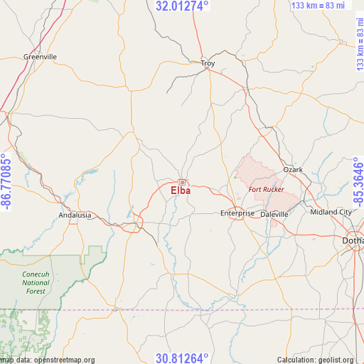
Elba GPS coordinates[2]
31° 24' 52.596" North, 86° 4' 3.792" West
| Map corner | latitude | longitude |
|---|---|---|
| Upper-left | 32.01274°, | -86.77085° |
| Center: | 31.41461°, | -86.06772° |
| Lower-right: | 30.81264°, | -85.3646° |
| Map W x H: | 133.4×133.4 km | = 82.9×82.9mi |
| max Lat: | 71.29058° ⇑89.8% North |
| Elba: | 31.41461° |
| min Lat: | ⇓10.2% South 19.06759° |
| min Long | Elba | max Long |
| -171.73463° | -86.06772° | -66.98998° |
| W 52.8%⇐ | ⇒47.2% E |
Elevation
Elevation of Elba is 61 m = 200 ft, and this is 233.8 m = 767 ft below average elevation for this country.
| Max E: |
3189 m = 10463 ft | 76.9% |
| Avg. | 294.8 m = 967 ft | |
| Elba | 61 m = 200 ft | |
Min E: |
-60 m = -197 ft | 23.1% |
See also: United States elevation on elevation.city.
Geographical zone
Elba is located in North temperate zone (between Tropic of Cancer and the Arctic Circle). Distance of this Northern Tropic circle is 887.1 km =551.2 mi to South.| Distance of | km | miles | from Elba |
|---|---|---|---|
| North Pole | 6514.1 | 4047.7 | to North |
| Arctic Circle | 3908.2 | 2428.4 | to North |
| Tropic Cancer | 887.1 | 551.2 | to South |
| Equator | 3493 | 2170.4 | to South |


Nearby cities:
15 places around Elba: (largest is in red/bold)
• Andalusia
41.1 km =25.5 mi,  253°
253°
• Ariton
39 km =24.2 mi,  58°
58°
• Babbie
28.7 km =17.8 mi,  238°
238°
• Brantley
25.9 km =16.1 mi,  316°
316°
• Clayhatchee
38.3 km =23.8 mi,  121°
121°
• Daleville
35.6 km =22.1 mi,  109°
109°
• Enterprise
23 km =14.3 mi, 118°
• Fort Rucker
34.4 km =21.4 mi,  103°
103°
• Kinston
24.2 km =15 mi,  203°
203°
• Level Plains
30.3 km =18.8 mi, 114°
• Luverne
38.4 km =23.9 mi,  331°
331°
• New Brockton
13.5 km =8.4 mi, 103°
• Opp
23.1 km =14.4 mi,  230°
230°
• Ozark
40.8 km =25.4 mi,  83°
83°
• Samson
33.6 km =20.9 mi,  176°
176°
Sources, notices
• [Note1] Compared only with cities in United States existing in our database
• [Src1] Map data: © OpenStreetMap contributors (CC-BY-SA)
• [Src2] Other city data from geonames.org with taken over terms of usage.
• [Src3] Geographical zone / Annual Mean Temperature by Robert A. Rohde @ Wikipedia
