Marvell geodata
Marvell (Arkansas) is a populated place; located in United States in America/Chicago (GMT-5) time zone. With population of 1,047 people, there are 15982 cities with bigger population in this country. Compared to other cities in United States, 77.4% of cities are located further ↑North; 61.9% of cities are located further →East and 76.7% of cities have higher elevation than Marvell. Note1
Administrative division(s):
- Level 1: Arkansas
- Level 2: Phillips County
- Level 3: Township of Hickory Ridge


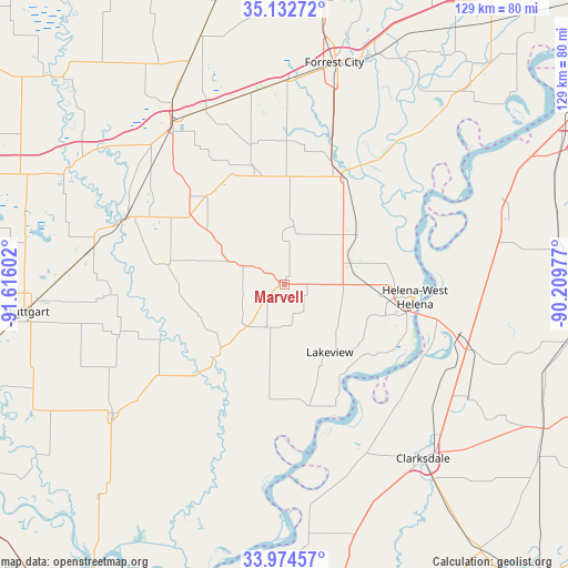
Marvell GPS coordinates[2]
34° 33' 20.376" North, 90° 54' 46.404" West
| Map corner | latitude | longitude |
|---|---|---|
| Upper-left | 35.13272°, | -91.61602° |
| Center: | 34.55566°, | -90.91289° |
| Lower-right: | 33.97457°, | -90.20977° |
| Map W x H: | 128.8×128.8 km | = 80×80mi |
| max Lat: | 71.29058° ⇑77.4% North |
| Marvell: | 34.55566° |
| min Lat: | ⇓22.6% South 19.06759° |
| min Long | Marvell | max Long |
| -171.73463° | -90.91289° | -66.98998° |
| W 38.1%⇐ | ⇒61.9% E |
Elevation
Elevation of Marvell is 62 m = 203 ft, and this is 232.8 m = 764 ft below average elevation for this country.
| Max E: |
3189 m = 10463 ft | 76.7% |
| Avg. | 294.8 m = 967 ft | |
| Marvell | 62 m = 203 ft | |
Min E: |
-60 m = -197 ft | 23.3% |
See also: United States elevation on elevation.city.
Geographical zone
Marvell is located in North temperate zone (between Tropic of Cancer and the Arctic Circle). Distance of this Northern Tropic circle is 1236.3 km =768.2 mi to South.| Distance of | km | miles | from Marvell |
|---|---|---|---|
| North Pole | 6164.8 | 3830.6 | to North |
| Arctic Circle | 3558.9 | 2211.4 | to North |
| Tropic Cancer | 1236.3 | 768.2 | to South |
| Equator | 3842.2 | 2387.4 | to South |


Nearby cities:
15 places around Marvell: (largest is in red/bold)
• Brinkley
45 km =28 mi,  325°
325°
• Clarendon
39.7 km =24.7 mi,  292°
292°
• Clarksdale
50.5 km =31.4 mi,  141°
141°
• De Witt
48.7 km =30.3 mi,  233°
233°
• Elaine
28 km =17.4 mi,  168°
168°
• Friars Point
32.5 km =20.2 mi,  129°
129°
• Helena
29.6 km =18.4 mi,  95°
95°
• Helena-West Helena
29.7 km =18.5 mi, 95°
• Holly Grove
26.6 km =16.5 mi,  279°
279°
• Jonestown
49.5 km =30.8 mi,  122°
122°
• Marianna
28.1 km =17.5 mi,  30°
30°
• North Tunica
51.5 km =32 mi,  71°
71°
• Palestine
46.3 km =28.8 mi,  1°
1°
• Tunica
50.6 km =31.4 mi, 73°
• West Helena
24.8 km =15.4 mi,  91°
91°
Sources, notices
• [Note1] Compared only with cities in United States existing in our database
• [Src1] Map data: © OpenStreetMap contributors (CC-BY-SA)
• [Src2] Other city data from geonames.org with taken over terms of usage.
• [Src3] Geographical zone / Annual Mean Temperature by Robert A. Rohde @ Wikipedia
