Neptune Beach geodata
Neptune Beach (Florida) is a populated place; located in United States in America/New_York (GMT-4) time zone. With population of 7,269 people, there are 5667 cities with bigger population in this country. Compared to other cities in United States, 92.5% of cities are located further ↑North; 68.1% of cities are located further ←West and 98.8% of cities have higher elevation than Neptune Beach. Note1


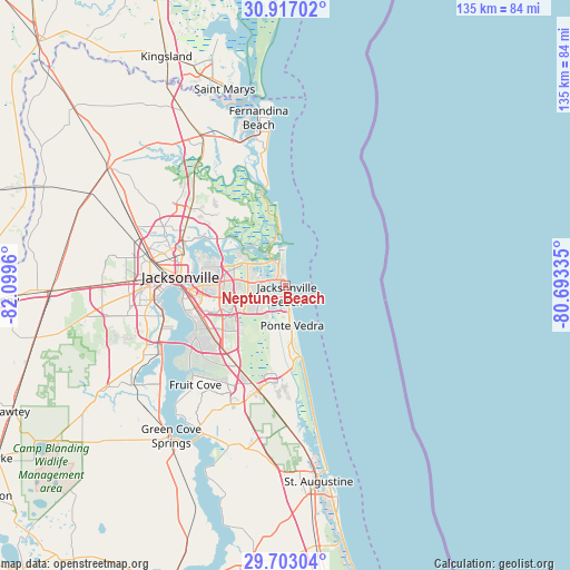
Neptune Beach GPS coordinates[2]
30° 18' 42.876" North, 81° 23' 47.292" West
| Map corner | latitude | longitude |
|---|---|---|
| Upper-left | 30.91702°, | -82.0996° |
| Center: | 30.31191°, | -81.39647° |
| Lower-right: | 29.70304°, | -80.69335° |
| Map W x H: | 135×135 km | = 83.9×83.9mi |
| max Lat: | 71.29058° ⇑92.5% North |
| Neptune Beach: | 30.31191° |
| min Lat: | ⇓7.5% South 19.06759° |
| min Long | Neptune Beach | max Long |
| -171.73463° | -81.39647° | -66.98998° |
| W 68.1%⇐ | ⇒31.9% E |
Elevation
Elevation of Neptune Beach is 4 m = 13 ft, and this is 290.8 m = 954 ft below average elevation for this country.
| Max E: |
3189 m = 10463 ft | 98.8% |
| Avg. | 294.8 m = 967 ft | |
| Neptune Beach | 4 m = 13 ft | |
Min E: |
-60 m = -197 ft | 1.2% |
See also: United States elevation on elevation.city.
Geographical zone
Neptune Beach is located in North temperate zone (between Tropic of Cancer and the Arctic Circle). Distance of this Northern Tropic circle is 764.4 km =475 mi to South.| Distance of | km | miles | from Neptune Beach |
|---|---|---|---|
| North Pole | 6636.7 | 4123.9 | to North |
| Arctic Circle | 4030.8 | 2504.6 | to North |
| Tropic Cancer | 764.4 | 475 | to South |
| Equator | 3370.4 | 2094.3 | to South |


Nearby cities:
15 places around Neptune Beach: (largest is in red/bold)
• Atlantic Beach
2.5 km =1.6 mi,  355°
355°
• Bellair-Meadowbrook Terrace
36.5 km =22.7 mi,  246°
246°
• Fernandina Beach
40.3 km =25 mi,  350°
350°
• Fleming Island
39.4 km =24.5 mi,  231°
231°
• Fruit Cove
32.5 km =20.2 mi, 226°
• Jacksonville
25 km =15.5 mi,  275°
275°
• Jacksonville Beach
1.9 km =1.2 mi,  170°
170°
• Lakeside
41 km =25.5 mi,  240°
240°
• Nocatee
25.4 km =15.8 mi,  181°
181°
• Orange Park
33.9 km =21.1 mi, 241°
• Palm Valley
15 km =9.3 mi, 176°
• Ponte Vedra Beach
8.1 km =5 mi, 172°
• Sawgrass
13.5 km =8.4 mi, 169°
• St. Johns
29.5 km =18.3 mi,  209°
209°
• Yulee
40.9 km =25.4 mi,  330°
330°
Sources, notices
• [Note1] Compared only with cities in United States existing in our database
• [Src1] Map data: © OpenStreetMap contributors (CC-BY-SA)
• [Src2] Other city data from geonames.org with taken over terms of usage.
• [Src3] Geographical zone / Annual Mean Temperature by Robert A. Rohde @ Wikipedia
