Fernandina Beach geodata
Fernandina Beach (Florida) is a seat of a second-order administrative division; located in United States in America/New_York (GMT-4) time zone. With population of 12,339 people, there are 3809 cities with bigger population in this country. Compared to other cities in United States, 91.3% of cities are located further ↑North; 67.8% of cities are located further ←West and 96.6% of cities have higher elevation than Fernandina Beach. Note1


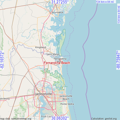
Fernandina Beach GPS coordinates[2]
30° 40' 10.848" North, 81° 27' 45.324" West
| Map corner | latitude | longitude |
|---|---|---|
| Upper-left | 31.27255°, | -82.16572° |
| Center: | 30.66968°, | -81.46259° |
| Lower-right: | 30.06302°, | -80.75947° |
| Map W x H: | 134.5×134.5 km | = 83.6×83.6mi |
| max Lat: | 71.29058° ⇑91.3% North |
| Fernandina Beach: | 30.66968° |
| min Lat: | ⇓8.7% South 19.06759° |
| min Long | Fernandina Beac | max Long |
| -171.73463° | -81.46259° | -66.98998° |
| W 67.8%⇐ | ⇒32.2% E |
Elevation
Elevation of Fernandina Beach is 7 m = 23 ft, and this is 287.8 m = 944 ft below average elevation for this country.
| Max E: |
3189 m = 10463 ft | 96.6% |
| Avg. | 294.8 m = 967 ft | |
| Fernandina Beach | 7 m = 23 ft | |
Min E: |
-60 m = -197 ft | 3.4% |
See also: United States elevation on elevation.city.
Geographical zone
Fernandina Beach is located in North temperate zone (between Tropic of Cancer and the Arctic Circle). Distance of this Northern Tropic circle is 804.2 km =499.7 mi to South.| Distance of | km | miles | from Fernandina Beach |
|---|---|---|---|
| North Pole | 6596.9 | 4099.1 | to North |
| Arctic Circle | 3991 | 2479.9 | to North |
| Tropic Cancer | 804.2 | 499.7 | to South |
| Equator | 3410.1 | 2118.9 | to South |


Nearby cities:
15 places around Fernandina Beach: (largest is in red/bold)
• Atlantic Beach
37.8 km =23.5 mi,  170°
170°
• Brunswick
53.5 km =33.2 mi,  357°
357°
• Callahan
37.2 km =23.1 mi,  251°
251°
• Hilliard
43.5 km =27 mi,  273°
273°
• Jacksonville
41.8 km =26 mi,  206°
206°
• Jacksonville Beach
42.2 km =26.2 mi, 170°
• Kings Bay Base
17.4 km =10.8 mi,  325°
325°
• Kingsland
26.1 km =16.2 mi,  303°
303°
• Nassau Village-Ratliff
37.6 km =23.4 mi,  242°
242°
• Neptune Beach
40.3 km =25 mi, 170°
• Ponte Vedra Beach
48.4 km =30.1 mi, 171°
• St Marys
14.2 km =8.8 mi,  312°
312°
• St. Marys
10.5 km =6.5 mi, 310°
• Woodbine
41.2 km =25.6 mi,  322°
322°
• Yulee
14.4 km =8.9 mi, 253°
Sources, notices
• [Note1] Compared only with cities in United States existing in our database
• [Src1] Map data: © OpenStreetMap contributors (CC-BY-SA)
• [Src2] Other city data from geonames.org with taken over terms of usage.
• [Src3] Geographical zone / Annual Mean Temperature by Robert A. Rohde @ Wikipedia
