Ocoee geodata
Ocoee (Florida) is a populated place; located in United States in America/New_York (GMT-4) time zone. With population of 43,608 people, there are 1095 cities with bigger population in this country. Compared to other cities in United States, 95.8% of cities are located further ↑North; 67.3% of cities are located further ←West and 80.9% of cities have higher elevation than Ocoee. Note1


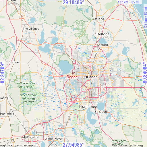
Ocoee GPS coordinates[2]
28° 34' 9.012" North, 81° 32' 38.256" West
| Map corner | latitude | longitude |
|---|---|---|
| Upper-left | 29.18486°, | -82.24709° |
| Center: | 28.56917°, | -81.54396° |
| Lower-right: | 27.94985°, | -80.84084° |
| Map W x H: | 137.3×137.3 km | = 85.3×85.3mi |
| max Lat: | 71.29058° ⇑95.8% North |
| Ocoee: | 28.56917° |
| min Lat: | ⇓4.2% South 19.06759° |
| min Long | Ocoee | max Long |
| -171.73463° | -81.54396° | -66.98998° |
| W 67.3%⇐ | ⇒32.7% E |
Elevation
Elevation of Ocoee is 43 m = 141 ft, and this is 251.8 m = 826 ft below average elevation for this country.
| Max E: |
3189 m = 10463 ft | 80.9% |
| Avg. | 294.8 m = 967 ft | |
| Ocoee | 43 m = 141 ft | |
Min E: |
-60 m = -197 ft | 19.1% |
See also: Ocoee elevation on elevation.city.
Geographical zone
Ocoee is located in North temperate zone (between Tropic of Cancer and the Arctic Circle). Distance of this Northern Tropic circle is 570.7 km =354.6 mi to South.| Distance of | km | miles | from Ocoee |
|---|---|---|---|
| North Pole | 6830.5 | 4244.3 | to North |
| Arctic Circle | 4224.6 | 2625 | to North |
| Tropic Cancer | 570.7 | 354.6 | to South |
| Equator | 3176.6 | 1973.8 | to South |


Nearby cities:
15 places around Ocoee: (largest is in red/bold)
• Apopka
12.3 km =7.6 mi,  14°
14°
• Bay Hill
11.6 km =7.2 mi,  166°
166°
• Clarcona
6.6 km =4.1 mi,  42°
42°
• Gotha
5 km =3.1 mi,  156°
156°
• Lake Butler
7.5 km =4.7 mi,  177°
177°
• Lockhart
11.4 km =7.1 mi,  60°
60°
• Montverde
13.2 km =8.2 mi,  285°
285°
• Oakland
8.8 km =5.5 mi,  259°
259°
• Orlovista
8.9 km =5.5 mi,  112°
112°
• Paradise Heights
6.1 km =3.8 mi,  0°
0°
• Pine Hills
8.9 km =5.5 mi,  98°
98°
• South Apopka
10.8 km =6.7 mi,  18°
18°
• Tildenville
6.4 km =4 mi, 260°
• Windermere
8.2 km =5.1 mi, 173°
• Winter Garden
4.1 km =2.5 mi, 264°
Sources, notices
• [Note1] Compared only with cities in United States existing in our database
• [Src1] Map data: © OpenStreetMap contributors (CC-BY-SA)
• [Src2] Other city data from geonames.org with taken over terms of usage.
• [Src3] Geographical zone / Annual Mean Temperature by Robert A. Rohde @ Wikipedia
