Ormond-by-the-Sea geodata
Ormond-by-the-Sea (Florida) is a populated place; located in United States in America/New_York (GMT-4) time zone. With population of 7,406 people, there are 5588 cities with bigger population in this country. Compared to other cities in United States, 94.9% of cities are located further ↑North; 69.3% of cities are located further ←West and 97.4% of cities have higher elevation than Ormond-by-the-Sea. Note1


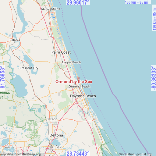
Ormond-by-the-Sea GPS coordinates[2]
29° 20' 56.904" North, 81° 3' 59.22" West
| Map corner | latitude | longitude |
|---|---|---|
| Upper-left | 29.96017°, | -81.76958° |
| Center: | 29.34914°, | -81.06645° |
| Lower-right: | 28.73443°, | -80.36333° |
| Map W x H: | 136.3×136.3 km | = 84.7×84.7mi |
| max Lat: | 71.29058° ⇑94.9% North |
| Ormond-by-the-Sea: | 29.34914° |
| min Lat: | ⇓5.1% South 19.06759° |
| min Long | Ormond-by-the-S | max Long |
| -171.73463° | -81.06645° | -66.98998° |
| W 69.3%⇐ | ⇒30.7% E |
Elevation
Elevation of Ormond-by-the-Sea is 6 m = 20 ft, and this is 288.8 m = 948 ft below average elevation for this country.
| Max E: |
3189 m = 10463 ft | 97.4% |
| Avg. | 294.8 m = 967 ft | |
| Ormond-by-the-Sea | 6 m = 20 ft | |
Min E: |
-60 m = -197 ft | 2.6% |
See also: United States elevation on elevation.city.
Geographical zone
Ormond-by-the-Sea is located in North temperate zone (between Tropic of Cancer and the Arctic Circle). Distance of this Northern Tropic circle is 657.4 km =408.5 mi to South.| Distance of | km | miles | from Ormond-by-the-Sea |
|---|---|---|---|
| North Pole | 6743.7 | 4190.3 | to North |
| Arctic Circle | 4137.9 | 2571.2 | to North |
| Tropic Cancer | 657.4 | 408.5 | to South |
| Equator | 3263.3 | 2027.7 | to South |


Nearby cities:
15 places around Ormond-by-the-Sea: (largest is in red/bold)
• Bunnell
22.6 km =14 mi,  305°
305°
• Daytona Beach
16 km =9.9 mi,  164°
164°
• Daytona Beach Shores
20.9 km =13 mi, 157°
• De Leon Springs
37.7 km =23.4 mi,  227°
227°
• Flagler Beach
15.2 km =9.4 mi,  337°
337°
• Glencoe
37.1 km =23.1 mi,  165°
165°
• Holly Hill
12.1 km =7.5 mi, 166°
• New Smyrna Beach
38.4 km =23.9 mi, 159°
• North DeLand
40.2 km =25 mi,  214°
214°
• Ormond Beach
7.1 km =4.4 mi, 171°
• Palm Coast
29.6 km =18.4 mi,  332°
332°
• Ponce Inlet
30.8 km =19.1 mi, 155°
• Port Orange
24.4 km =15.2 mi, 163°
• Samsula-Spruce Creek
33.3 km =20.7 mi,  179°
179°
• South Daytona
21.3 km =13.2 mi, 163°
Sources, notices
• [Note1] Compared only with cities in United States existing in our database
• [Src1] Map data: © OpenStreetMap contributors (CC-BY-SA)
• [Src2] Other city data from geonames.org with taken over terms of usage.
• [Src3] Geographical zone / Annual Mean Temperature by Robert A. Rohde @ Wikipedia
