Jefferson geodata
Jefferson (Georgia) is a populated place; located in United States in America/New_York (GMT-4) time zone. With population of 4,411 people, there are 7738 cities with bigger population in this country. Compared to other cities in United States, 83.4% of cities are located further ↑North; 61.1% of cities are located further ←West and 56.9% of cities have higher elevation than Jefferson. Note1


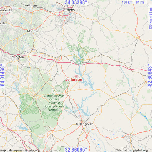
Jefferson GPS coordinates[2]
33° 26' 57.48" North, 83° 18' 41.58" West
| Map corner | latitude | longitude |
|---|---|---|
| Upper-left | 34.03398°, | -84.01468° |
| Center: | 33.4493°, | -83.31155° |
| Lower-right: | 32.86065°, | -82.60843° |
| Map W x H: | 130.5×130.5 km | = 81.1×81.1mi |
| max Lat: | 71.29058° ⇑83.4% North |
| Jefferson: | 33.4493° |
| min Lat: | ⇓16.6% South 19.06759° |
| min Long | Jefferson | max Long |
| -171.73463° | -83.31155° | -66.98998° |
| W 61.1%⇐ | ⇒38.9% E |
Elevation
Elevation of Jefferson is 171 m = 561 ft, and this is 123.8 m = 406 ft below average elevation for this country.
| Max E: |
3189 m = 10463 ft | 56.9% |
| Avg. | 294.8 m = 967 ft | |
| Jefferson | 171 m = 561 ft | |
Min E: |
-60 m = -197 ft | 43.1% |
See also: United States elevation on elevation.city.
Geographical zone
Jefferson is located in North temperate zone (between Tropic of Cancer and the Arctic Circle). Distance of this Northern Tropic circle is 1113.3 km =691.8 mi to South.| Distance of | km | miles | from Jefferson |
|---|---|---|---|
| North Pole | 6287.8 | 3907.1 | to North |
| Arctic Circle | 3682 | 2287.9 | to North |
| Tropic Cancer | 1113.3 | 691.8 | to South |
| Equator | 3719.2 | 2311 | to South |


Nearby cities:
15 places around Jefferson: (largest is in red/bold)
• Crawfordville
40.3 km =25 mi,  73°
73°
• Eatonton
15.4 km =9.6 mi,  207°
207°
• Greensboro
18.5 km =11.5 mi,  40°
40°
• Hardwick
43.2 km =26.8 mi,  169°
169°
• Madison
21.8 km =13.5 mi,  318°
318°
• Milledgeville
41.7 km =25.9 mi, 169°
• Monticello
38.1 km =23.7 mi,  245°
245°
• Mount Zion
29.9 km =18.6 mi,  109°
109°
• Newborn
36.4 km =22.6 mi,  281°
281°
• North High Shoals
45 km =28 mi,  336°
336°
• Rutledge
34.1 km =21.2 mi,  305°
305°
• Social Circle
44.2 km =27.5 mi,  301°
301°
• Sparta
36.6 km =22.7 mi,  121°
121°
• Union Point
28.7 km =17.8 mi,  49°
49°
• Watkinsville
46.9 km =29.1 mi,  348°
348°
Sources, notices
• [Note1] Compared only with cities in United States existing in our database
• [Src1] Map data: © OpenStreetMap contributors (CC-BY-SA)
• [Src2] Other city data from geonames.org with taken over terms of usage.
• [Src3] Geographical zone / Annual Mean Temperature by Robert A. Rohde @ Wikipedia
