Palmetto geodata
Palmetto (Georgia) is a populated place; located in United States in America/New_York (GMT-4) time zone. With population of 4,733 people, there are 7406 cities with bigger population in this country. Compared to other cities in United States, 83% of cities are located further ↑North; 56.7% of cities are located further ←West and 75.4% of cities have lower elevation than Palmetto. Note1


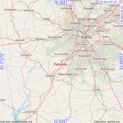
Palmetto GPS coordinates[2]
33° 31' 4.404" North, 84° 40' 10.74" West
| Map corner | latitude | longitude |
|---|---|---|
| Upper-left | 34.1021°, | -85.37278° |
| Center: | 33.51789°, | -84.66965° |
| Lower-right: | 32.9297°, | -83.96653° |
| Map W x H: | 130.4×130.4 km | = 81×81mi |
| max Lat: | 71.29058° ⇑83% North |
| Palmetto: | 33.51789° |
| min Lat: | ⇓17% South 19.06759° |
| min Long | Palmetto | max Long |
| -171.73463° | -84.66965° | -66.98998° |
| W 56.7%⇐ | ⇒43.3% E |
Elevation
Elevation of Palmetto is 316 m = 1037 ft, and this is 21.2 m = 70 ft above average elevation for this country.
| Max E: |
3189 m = 10463 ft | 24.6% |
| Palmetto | 316 m 1037 ft | |
| Avg. | 294.8 m = 967 ft | |
Min E: |
-60 m = -197 ft | 75.4% |
See also: United States elevation on elevation.city.
Geographical zone
Palmetto is located in North temperate zone (between Tropic of Cancer and the Arctic Circle). Distance of this Northern Tropic circle is 1120.9 km =696.5 mi to South.| Distance of | km | miles | from Palmetto |
|---|---|---|---|
| North Pole | 6280.2 | 3902.3 | to North |
| Arctic Circle | 3674.3 | 2283.1 | to North |
| Tropic Cancer | 1120.9 | 696.5 | to South |
| Equator | 3726.8 | 2315.7 | to South |


Nearby cities:
15 places around Palmetto: (largest is in red/bold)
• Chattahoochee Hills
9.2 km =5.7 mi,  293°
293°
• College Park
25.4 km =15.8 mi,  53°
53°
• Douglasville
27 km =16.8 mi,  344°
344°
• East Newnan
21.1 km =13.1 mi,  208°
208°
• East Point
27.9 km =17.3 mi, 49°
• Fairburn
9.9 km =6.2 mi,  56°
56°
• Fayetteville
21.3 km =13.2 mi,  111°
111°
• Newnan
19.4 km =12.1 mi,  218°
218°
• Peachtree City
15.1 km =9.4 mi,  153°
153°
• Riverdale
24.5 km =15.2 mi,  75°
75°
• Senoia
26.3 km =16.3 mi,  155°
155°
• Shannon
22.5 km =14 mi,  124°
124°
• Tyrone
8.5 km =5.3 mi,  127°
127°
• Union City
14.1 km =8.8 mi, 56°
• Whitesburg
22.8 km =14.2 mi,  263°
263°
Sources, notices
• [Note1] Compared only with cities in United States existing in our database
• [Src1] Map data: © OpenStreetMap contributors (CC-BY-SA)
• [Src2] Other city data from geonames.org with taken over terms of usage.
• [Src3] Geographical zone / Annual Mean Temperature by Robert A. Rohde @ Wikipedia
