Waynesboro geodata
Waynesboro (Georgia) is a seat of a second-order administrative division; located in United States in America/New_York (GMT-4) time zone. With population of 5,704 people, there are 6605 cities with bigger population in this country. Compared to other cities in United States, 84.8% of cities are located further ↑North; 65.5% of cities are located further ←West and 71.3% of cities have higher elevation than Waynesboro. Note1


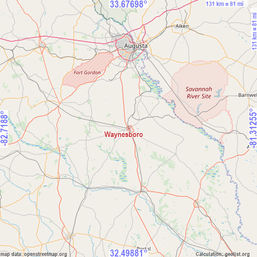
Waynesboro GPS coordinates[2]
33° 5' 23.532" North, 82° 0' 56.412" West
| Map corner | latitude | longitude |
|---|---|---|
| Upper-left | 33.67698°, | -82.7188° |
| Center: | 33.08987°, | -82.01567° |
| Lower-right: | 32.49881°, | -81.31255° |
| Map W x H: | 131×131 km | = 81.4×81.4mi |
| max Lat: | 71.29058° ⇑84.8% North |
| Waynesboro: | 33.08987° |
| min Lat: | ⇓15.2% South 19.06759° |
| min Long | Waynesboro | max Long |
| -171.73463° | -82.01567° | -66.98998° |
| W 65.5%⇐ | ⇒34.5% E |
Elevation
Elevation of Waynesboro is 93 m = 305 ft, and this is 201.8 m = 662 ft below average elevation for this country.
| Max E: |
3189 m = 10463 ft | 71.3% |
| Avg. | 294.8 m = 967 ft | |
| Waynesboro | 93 m = 305 ft | |
Min E: |
-60 m = -197 ft | 28.7% |
See also: United States elevation on elevation.city.
Geographical zone
Waynesboro is located in North temperate zone (between Tropic of Cancer and the Arctic Circle). Distance of this Northern Tropic circle is 1073.3 km =666.9 mi to South.| Distance of | km | miles | from Waynesboro |
|---|---|---|---|
| North Pole | 6327.8 | 3931.9 | to North |
| Arctic Circle | 3721.9 | 2312.7 | to North |
| Tropic Cancer | 1073.3 | 666.9 | to South |
| Equator | 3679.2 | 2286.1 | to South |


Nearby cities:
15 places around Waynesboro: (largest is in red/bold)
• Augusta
42.5 km =26.4 mi,  5°
5°
• Blythe
28.4 km =17.6 mi,  322°
322°
• Clearwater
46.7 km =29 mi, 14°
• Grovetown
43.5 km =27 mi,  337°
337°
• Harlem
45.5 km =28.3 mi, 322°
• Hephzibah
26 km =16.2 mi, 343°
• Jackson
33.7 km =20.9 mi,  38°
38°
• Kingston
43.8 km =27.2 mi,  352°
352°
• Louisville
38.2 km =23.7 mi,  255°
255°
• Martinez
47.9 km =29.8 mi, 353°
• Millen
32.4 km =20.1 mi,  168°
168°
• North Augusta
46 km =28.6 mi, 5°
• Sardis
27.2 km =16.9 mi,  117°
117°
• Wadley
43.9 km =27.3 mi,  235°
235°
• Wrens
37.4 km =23.2 mi,  290°
290°
Sources, notices
• [Note1] Compared only with cities in United States existing in our database
• [Src1] Map data: © OpenStreetMap contributors (CC-BY-SA)
• [Src2] Other city data from geonames.org with taken over terms of usage.
• [Src3] Geographical zone / Annual Mean Temperature by Robert A. Rohde @ Wikipedia
