Elizabethtown geodata
Elizabethtown (Illinois) is a seat of a second-order administrative division; located in United States in America/Chicago (GMT-5) time zone. With population of 287 people, there are 20978 cities with bigger population in this country. Compared to other cities in United States, 64.2% of cities are located further ↑North; 54.1% of cities are located further →East and 68.3% of cities have higher elevation than Elizabethtown. Note1


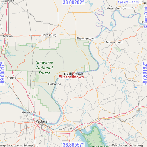
Elizabethtown GPS coordinates[2]
37° 26' 45.168" North, 88° 18' 18.144" West
| Map corner | latitude | longitude |
|---|---|---|
| Upper-left | 38.00202°, | -89.00817° |
| Center: | 37.44588°, | -88.30504° |
| Lower-right: | 36.88557°, | -87.60192° |
| Map W x H: | 124.1×124.1 km | = 77.1×77.1mi |
| max Lat: | 71.29058° ⇑64.2% North |
| Elizabethtown: | 37.44588° |
| min Lat: | ⇓35.8% South 19.06759° |
| min Long | Elizabethtown | max Long |
| -171.73463° | -88.30504° | -66.98998° |
| W 45.9%⇐ | ⇒54.1% E |
Elevation
Elevation of Elizabethtown is 111 m = 364 ft, and this is 183.8 m = 603 ft below average elevation for this country.
| Max E: |
3189 m = 10463 ft | 68.3% |
| Avg. | 294.8 m = 967 ft | |
| Elizabethtown | 111 m = 364 ft | |
Min E: |
-60 m = -197 ft | 31.7% |
See also: United States elevation on elevation.city.
Geographical zone
Elizabethtown is located in North temperate zone (between Tropic of Cancer and the Arctic Circle). Distance of this Northern Tropic circle is 1557.7 km =967.9 mi to South.| Distance of | km | miles | from Elizabethtown |
|---|---|---|---|
| North Pole | 5843.5 | 3631 | to North |
| Arctic Circle | 3237.6 | 2011.8 | to North |
| Tropic Cancer | 1557.7 | 967.9 | to South |
| Equator | 4163.6 | 2587.1 | to South |


Nearby cities:
15 places around Elizabethtown: (largest is in red/bold)
• Carrier Mills
39.2 km =24.4 mi,  312°
312°
• Clay
42.9 km =26.7 mi,  85°
85°
• Eddyville
43.8 km =27.2 mi,  153°
153°
• Eldorado
42.5 km =26.4 mi,  344°
344°
• Equality
32.2 km =20 mi,  353°
353°
• Golconda
18.3 km =11.4 mi,  241°
241°
• Harrisburg
38.6 km =24 mi,  327°
327°
• Marion
23.4 km =14.5 mi,  122°
122°
• Morganfield
43.2 km =26.8 mi,  52°
52°
• Ridgway
39.5 km =24.5 mi,  5°
5°
• Rosiclare
4.4 km =2.7 mi, 235°
• Salem
20.9 km =13 mi,  165°
165°
• Shawneetown
31.5 km =19.6 mi,  19°
19°
• Smithland
35.2 km =21.9 mi,  194°
194°
• Sturgis
30.5 km =19 mi,  68°
68°
Sources, notices
• [Note1] Compared only with cities in United States existing in our database
• [Src1] Map data: © OpenStreetMap contributors (CC-BY-SA)
• [Src2] Other city data from geonames.org with taken over terms of usage.
• [Src3] Geographical zone / Annual Mean Temperature by Robert A. Rohde @ Wikipedia
