Morganfield geodata
Morganfield (Kentucky) is a seat of a second-order administrative division; located in United States in America/Chicago (GMT-5) time zone. With population of 3,578 people, there are 8756 cities with bigger population in this country. Compared to other cities in United States, 63.3% of cities are located further ↑North; 52.5% of cities are located further →East and 64.4% of cities have higher elevation than Morganfield. Note1


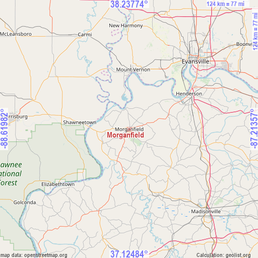
Morganfield GPS coordinates[2]
37° 41' 0.168" North, 87° 55' 0.084" West
| Map corner | latitude | longitude |
|---|---|---|
| Upper-left | 38.23774°, | -88.61982° |
| Center: | 37.68338°, | -87.91669° |
| Lower-right: | 37.12484°, | -87.21357° |
| Map W x H: | 123.7×123.7 km | = 76.9×76.9mi |
| max Lat: | 71.29058° ⇑63.3% North |
| Morganfield: | 37.68338° |
| min Lat: | ⇓36.7% South 19.06759° |
| min Long | Morganfield | max Long |
| -171.73463° | -87.91669° | -66.98998° |
| W 47.5%⇐ | ⇒52.5% E |
Elevation
Elevation of Morganfield is 131 m = 430 ft, and this is 163.8 m = 537 ft below average elevation for this country.
| Max E: |
3189 m = 10463 ft | 64.4% |
| Avg. | 294.8 m = 967 ft | |
| Morganfield | 131 m = 430 ft | |
Min E: |
-60 m = -197 ft | 35.6% |
See also: United States elevation on elevation.city.
Geographical zone
Morganfield is located in North temperate zone (between Tropic of Cancer and the Arctic Circle). Distance of this Northern Tropic circle is 1584.1 km =984.3 mi to South.| Distance of | km | miles | from Morganfield |
|---|---|---|---|
| North Pole | 5817.1 | 3614.6 | to North |
| Arctic Circle | 3211.2 | 1995.3 | to North |
| Tropic Cancer | 1584.1 | 984.3 | to South |
| Equator | 4190 | 2603.5 | to South |


Nearby cities:
15 places around Morganfield: (largest is in red/bold)
• Breckinridge Center
4.7 km =2.9 mi,  90°
90°
• Clay
24.5 km =15.2 mi,  159°
159°
• Corydon
19.9 km =12.4 mi,  70°
70°
• Dixon
27.1 km =16.8 mi,  132°
132°
• Equality
38 km =23.6 mi,  278°
278°
• Henderson
33.4 km =20.8 mi,  59°
59°
• Marion
41.6 km =25.8 mi,  200°
200°
• Mount Vernon
27.7 km =17.2 mi,  3°
3°
• Providence
34.6 km =21.5 mi, 156°
• Ridgway
32.9 km =20.4 mi,  293°
293°
• Robards
32.6 km =20.3 mi, 91°
• Sebree
35.2 km =21.9 mi,  103°
103°
• Shawneetown
24 km =14.9 mi, 277°
• Sturgis
16.3 km =10.1 mi, 201°
• Uniontown
10.3 km =6.4 mi,  353°
353°
Sources, notices
• [Note1] Compared only with cities in United States existing in our database
• [Src1] Map data: © OpenStreetMap contributors (CC-BY-SA)
• [Src2] Other city data from geonames.org with taken over terms of usage.
• [Src3] Geographical zone / Annual Mean Temperature by Robert A. Rohde @ Wikipedia
