Sullivan geodata
Sullivan (Illinois) is a seat of a second-order administrative division; located in United States in America/Chicago (GMT-5) time zone. With population of 4,494 people, there are 7648 cities with bigger population in this country. Compared to other cities in United States, 50.1% of cities are located further ↑North; 55.1% of cities are located further →East and 52.2% of cities have lower elevation than Sullivan. Note1
Administrative division(s):
- Level 1: Illinois
- Level 2: Moultrie County
- Level 3: Township of Sullivan


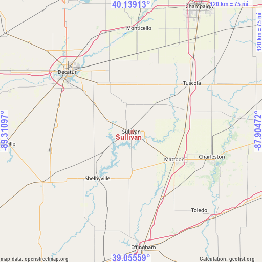
Sullivan GPS coordinates[2]
39° 35' 58.128" North, 88° 36' 28.224" West
| Map corner | latitude | longitude |
|---|---|---|
| Upper-left | 40.13913°, | -89.31097° |
| Center: | 39.59948°, | -88.60784° |
| Lower-right: | 39.05559°, | -87.90472° |
| Map W x H: | 120.5×120.5 km | = 74.9×74.9mi |
| max Lat: | 71.29058° ⇑50.1% North |
| Sullivan: | 39.59948° |
| min Lat: | ⇓49.9% South 19.06759° |
| min Long | Sullivan | max Long |
| -171.73463° | -88.60784° | -66.98998° |
| W 44.9%⇐ | ⇒55.1% E |
Elevation
Elevation of Sullivan is 207 m = 679 ft, and this is 87.8 m = 288 ft below average elevation for this country.
| Max E: |
3189 m = 10463 ft | 47.8% |
| Avg. | 294.8 m = 967 ft | |
| Sullivan | 207 m = 679 ft | |
Min E: |
-60 m = -197 ft | 52.2% |
See also: United States elevation on elevation.city.
Geographical zone
Sullivan is located in North temperate zone (between Tropic of Cancer and the Arctic Circle). Distance of this Northern Tropic circle is 1797.1 km =1116.7 mi to South.| Distance of | km | miles | from Sullivan |
|---|---|---|---|
| North Pole | 5604 | 3482.2 | to North |
| Arctic Circle | 2998.1 | 1862.9 | to North |
| Tropic Cancer | 1797.1 | 1116.7 | to South |
| Equator | 4403 | 2735.9 | to South |


Nearby cities:
15 places around Sullivan: (largest is in red/bold)
• Arcola
27.5 km =17.1 mi,  69°
69°
• Arthur
17.3 km =10.7 mi,  42°
42°
• Atwood
25.5 km =15.8 mi,  29°
29°
• Bethany
12.3 km =7.6 mi,  294°
294°
• Cerro Gordo
34 km =21.1 mi,  342°
342°
• Chapin
34.4 km =21.4 mi, 335°
• Dalton City
21 km =13 mi,  306°
306°
• Findlay
15.1 km =9.4 mi,  235°
235°
• Long Creek
31.3 km =19.4 mi,  319°
319°
• Lovington
13.1 km =8.1 mi,  350°
350°
• Mattoon
23.9 km =14.9 mi,  122°
122°
• Mount Zion
29.8 km =18.5 mi, 309°
• Neoga
33.9 km =21.1 mi,  156°
156°
• Shelbyville
26.6 km =16.5 mi,  216°
216°
• Windsor
17.7 km =11 mi,  176°
176°
Sources, notices
• [Note1] Compared only with cities in United States existing in our database
• [Src1] Map data: © OpenStreetMap contributors (CC-BY-SA)
• [Src2] Other city data from geonames.org with taken over terms of usage.
• [Src3] Geographical zone / Annual Mean Temperature by Robert A. Rohde @ Wikipedia
