Clinton geodata
Clinton (Indiana) is a populated place; located in United States in America/Indiana/Indianapolis (GMT-4) time zone. With population of 4,811 people, there are 7343 cities with bigger population in this country. Compared to other cities in United States, 50.4% of cities are located further ↓South; 50.6% of cities are located further →East and 61.1% of cities have higher elevation than Clinton. Note1
Administrative division(s):
- Level 1: Indiana
- Level 2: Vermillion County
- Level 3: Township of Clinton


Clinton GPS coordinates[2]
39° 39' 25.128" North, 87° 23' 53.052" West
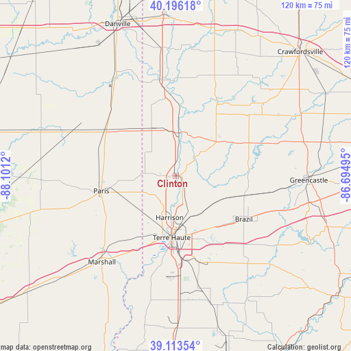
| Map corner | latitude | longitude |
|---|---|---|
| Upper-left | 40.19618°, | -88.1012° |
| Center: | 39.65698°, | -87.39807° |
| Lower-right: | 39.11354°, | -86.69495° |
| Map W x H: | 120.4×120.4 km | = 74.8×74.8mi |
| max Lat: | 71.29058° ⇑49.6% North |
| Clinton: | 39.65698° |
| min Lat: | ⇓50.4% South 19.06759° |
| min Long | Clinton | max Long |
| -171.73463° | -87.39807° | -66.98998° |
| W 49.4%⇐ | ⇒50.6% E |
Elevation
Elevation of Clinton is 149 m = 489 ft, and this is 145.8 m = 478 ft below average elevation for this country.
| Max E: |
3189 m = 10463 ft | 61.1% |
| Avg. | 294.8 m = 967 ft | |
| Clinton | 149 m = 489 ft | |
Min E: |
-60 m = -197 ft | 38.9% |
See also: United States elevation on elevation.city.
Geographical zone
Clinton is located in North temperate zone (between Tropic of Cancer and the Arctic Circle). Distance of this Northern Tropic circle is 1803.5 km =1120.6 mi to South.| Distance of | km | miles | from Clinton |
|---|---|---|---|
| North Pole | 5597.6 | 3478.2 | to North |
| Arctic Circle | 2991.7 | 1859 | to North |
| Tropic Cancer | 1803.5 | 1120.6 | to South |
| Equator | 4409.4 | 2739.9 | to South |


Nearby cities:
15 places around Clinton: (largest is in red/bold)
• Dana
18.7 km =11.6 mi,  333°
333°
• Fairview Park
3.1 km =1.9 mi, 327°
• Montezuma
15.3 km =9.5 mi,  8°
8°
• Newport
25.3 km =15.7 mi,  357°
357°
• North Terre Haute
14.7 km =9.1 mi,  167°
167°
• Paris
26 km =16.2 mi,  258°
258°
• Rockville
18.6 km =11.6 mi,  50°
50°
• Rosedale
10.5 km =6.5 mi,  111°
111°
• Saint Bernice
12 km =7.5 mi,  298°
298°
• Saint Mary-of-the-Woods
17.3 km =10.7 mi,  200°
200°
• Seelyville
21.5 km =13.4 mi,  148°
148°
• Staunton
26 km =16.2 mi,  136°
136°
• Tecumseh
10.6 km =6.6 mi,  190°
190°
• Terre Haute
21.2 km =13.2 mi,  183°
183°
• West Terre Haute
21.8 km =13.5 mi, 191°
Sources, notices
• [Note1] Compared only with cities in United States existing in our database
• [Src1] Map data: © OpenStreetMap contributors (CC-BY-SA)
• [Src2] Other city data from geonames.org with taken over terms of usage.
• [Src3] Geographical zone / Annual Mean Temperature by Robert A. Rohde @ Wikipedia
