Kevil geodata
Kevil (Kentucky) is a populated place; located in United States in America/Chicago (GMT-5) time zone. With population of 620 people, there are 19469 cities with bigger population in this country. Compared to other cities in United States, 65.8% of cities are located further ↑North; 55.8% of cities are located further →East and 64.2% of cities have higher elevation than Kevil. Note1


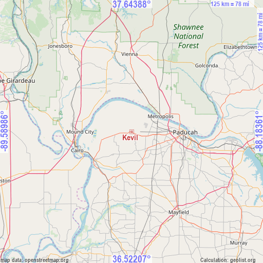
Kevil GPS coordinates[2]
37° 5' 6.18" North, 88° 53' 12.228" West
| Map corner | latitude | longitude |
|---|---|---|
| Upper-left | 37.64388°, | -89.58986° |
| Center: | 37.08505°, | -88.88673° |
| Lower-right: | 36.52207°, | -88.18361° |
| Map W x H: | 124.7×124.7 km | = 77.5×77.5mi |
| max Lat: | 71.29058° ⇑65.8% North |
| Kevil: | 37.08505° |
| min Lat: | ⇓34.2% South 19.06759° |
| min Long | Kevil | max Long |
| -171.73463° | -88.88673° | -66.98998° |
| W 44.2%⇐ | ⇒55.8% E |
Elevation
Elevation of Kevil is 132 m = 433 ft, and this is 162.8 m = 534 ft below average elevation for this country.
| Max E: |
3189 m = 10463 ft | 64.2% |
| Avg. | 294.8 m = 967 ft | |
| Kevil | 132 m = 433 ft | |
Min E: |
-60 m = -197 ft | 35.8% |
See also: United States elevation on elevation.city.
Geographical zone
Kevil is located in North temperate zone (between Tropic of Cancer and the Arctic Circle). Distance of this Northern Tropic circle is 1517.6 km =943 mi to South.| Distance of | km | miles | from Kevil |
|---|---|---|---|
| North Pole | 5883.6 | 3655.9 | to North |
| Arctic Circle | 3277.7 | 2036.7 | to North |
| Tropic Cancer | 1517.6 | 943 | to South |
| Equator | 4123.5 | 2562.2 | to South |


Nearby cities:
15 places around Kevil: (largest is in red/bold)
• Bardwell
26.2 km =16.3 mi,  204°
204°
• Barlow
14.7 km =9.1 mi,  255°
255°
• Brookport
23.1 km =14.4 mi,  79°
79°
• Cairo
27.2 km =16.9 mi,  250°
250°
• Farley
28.6 km =17.8 mi,  98°
98°
• Hendron
23.4 km =14.5 mi, 102°
• La Center
7.8 km =4.8 mi, 263°
• Ledbetter
36.6 km =22.7 mi, 96°
• Massac
15.8 km =9.8 mi,  118°
118°
• Metropolis
15.6 km =9.7 mi,  61°
61°
• Mound City
24.5 km =15.2 mi,  270°
270°
• Mounds
27.8 km =17.3 mi,  276°
276°
• Paducah
25.4 km =15.8 mi,  90°
90°
• Reidland
32.4 km =20.1 mi, 103°
• Wickliffe
22.4 km =13.9 mi,  233°
233°
Sources, notices
• [Note1] Compared only with cities in United States existing in our database
• [Src1] Map data: © OpenStreetMap contributors (CC-BY-SA)
• [Src2] Other city data from geonames.org with taken over terms of usage.
• [Src3] Geographical zone / Annual Mean Temperature by Robert A. Rohde @ Wikipedia
