Mortons Gap geodata
Mortons Gap (Kentucky) is a populated place; located in United States in America/Chicago (GMT-5) time zone. With population of 852 people, there are 17346 cities with bigger population in this country. Compared to other cities in United States, 65.2% of cities are located further ↑North; 50.7% of cities are located further →East and 62.2% of cities have higher elevation than Mortons Gap. Note1


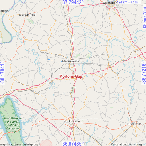
Mortons Gap GPS coordinates[2]
37° 14' 12.156" North, 87° 28' 31.008" West
| Map corner | latitude | longitude |
|---|---|---|
| Upper-left | 37.79442°, | -88.17841° |
| Center: | 37.23671°, | -87.47528° |
| Lower-right: | 36.67485°, | -86.77216° |
| Map W x H: | 124.5×124.5 km | = 77.4×77.4mi |
| max Lat: | 71.29058° ⇑65.2% North |
| Mortons Gap: | 37.23671° |
| min Lat: | ⇓34.8% South 19.06759° |
| min Long | Mortons Gap | max Long |
| -171.73463° | -87.47528° | -66.98998° |
| W 49.3%⇐ | ⇒50.7% E |
Elevation
Elevation of Mortons Gap is 143 m = 469 ft, and this is 151.8 m = 498 ft below average elevation for this country.
| Max E: |
3189 m = 10463 ft | 62.2% |
| Avg. | 294.8 m = 967 ft | |
| Mortons Gap | 143 m = 469 ft | |
Min E: |
-60 m = -197 ft | 37.8% |
See also: United States elevation on elevation.city.
Geographical zone
Mortons Gap is located in North temperate zone (between Tropic of Cancer and the Arctic Circle). Distance of this Northern Tropic circle is 1534.4 km =953.4 mi to South.| Distance of | km | miles | from Mortons Gap |
|---|---|---|---|
| North Pole | 5866.7 | 3645.4 | to North |
| Arctic Circle | 3260.8 | 2026.2 | to North |
| Tropic Cancer | 1534.4 | 953.4 | to South |
| Equator | 4140.3 | 2572.7 | to South |


Nearby cities:
15 places around Mortons Gap: (largest is in red/bold)
• Calhoun
38.7 km =24 mi,  29°
29°
• Central City
31.8 km =19.8 mi,  78°
78°
• Crofton
21 km =13 mi,  182°
182°
• Dawson Springs
20.7 km =12.9 mi,  248°
248°
• Dixon
36.6 km =22.7 mi,  328°
328°
• Drakesboro
37.8 km =23.5 mi,  93°
93°
• Earlington
5.3 km =3.3 mi,  322°
322°
• Greenville
26.5 km =16.5 mi,  98°
98°
• Hanson
20.1 km =12.5 mi,  358°
358°
• Madisonville
10.4 km =6.5 mi,  348°
348°
• Morehead
26.7 km =16.6 mi, 81°
• Nortonville
5.5 km =3.4 mi,  158°
158°
• Powderly
28 km =17.4 mi, 89°
• Providence
31.1 km =19.3 mi,  305°
305°
• White Plains
10 km =6.2 mi,  126°
126°
Sources, notices
• [Note1] Compared only with cities in United States existing in our database
• [Src1] Map data: © OpenStreetMap contributors (CC-BY-SA)
• [Src2] Other city data from geonames.org with taken over terms of usage.
• [Src3] Geographical zone / Annual Mean Temperature by Robert A. Rohde @ Wikipedia
