Carlyss geodata
Carlyss (Louisiana) is a populated place; located in United States in America/Chicago (GMT-5) time zone. With population of 4,670 people, there are 7469 cities with bigger population in this country. Compared to other cities in United States, 92.9% of cities are located further ↑North; 67.2% of cities are located further →East and 96.6% of cities have higher elevation than Carlyss. Note1


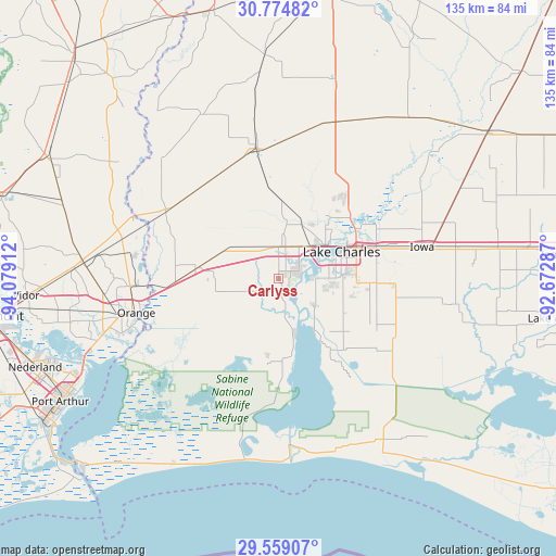
Carlyss GPS coordinates[2]
30° 10' 7.752" North, 93° 22' 33.564" West
| Map corner | latitude | longitude |
|---|---|---|
| Upper-left | 30.77482°, | -94.07912° |
| Center: | 30.16882°, | -93.37599° |
| Lower-right: | 29.55907°, | -92.67287° |
| Map W x H: | 135.2×135.2 km | = 84×84mi |
| max Lat: | 71.29058° ⇑92.9% North |
| Carlyss: | 30.16882° |
| min Lat: | ⇓7.1% South 19.06759° |
| min Long | Carlyss | max Long |
| -171.73463° | -93.37599° | -66.98998° |
| W 32.8%⇐ | ⇒67.2% E |
Elevation
Elevation of Carlyss is 7 m = 23 ft, and this is 287.8 m = 944 ft below average elevation for this country.
| Max E: |
3189 m = 10463 ft | 96.6% |
| Avg. | 294.8 m = 967 ft | |
| Carlyss | 7 m = 23 ft | |
Min E: |
-60 m = -197 ft | 3.4% |
See also: United States elevation on elevation.city.
Geographical zone
Carlyss is located in North temperate zone (between Tropic of Cancer and the Arctic Circle). Distance of this Northern Tropic circle is 748.5 km =465.1 mi to South.| Distance of | km | miles | from Carlyss |
|---|---|---|---|
| North Pole | 6652.6 | 4133.7 | to North |
| Arctic Circle | 4046.7 | 2514.5 | to North |
| Tropic Cancer | 748.5 | 465.1 | to South |
| Equator | 3354.5 | 2084.4 | to South |


Nearby cities:
15 places around Carlyss: (largest is in red/bold)
• DeQuincy
31.8 km =19.8 mi,  350°
350°
• Deweyville
38.1 km =23.7 mi,  292°
292°
• Gillis
28.3 km =17.6 mi,  36°
36°
• Hackberry
19.5 km =12.1 mi,  170°
170°
• Iowa
35.6 km =22.1 mi,  77°
77°
• Lake Charles
17.2 km =10.7 mi,  73°
73°
• Moss Bluff
23.2 km =14.4 mi,  50°
50°
• Orange
35.7 km =22.2 mi,  256°
256°
• Pinehurst
38.9 km =24.2 mi, 259°
• Prien
9.9 km =6.2 mi, 81°
• Starks
31.9 km =19.8 mi,  300°
300°
• Sulphur
7.5 km =4.7 mi,  358°
358°
• Vinton
19.9 km =12.4 mi,  277°
277°
• West Orange
38 km =23.6 mi, 255°
• Westlake
14.5 km =9 mi,  55°
55°
Sources, notices
• [Note1] Compared only with cities in United States existing in our database
• [Src1] Map data: © OpenStreetMap contributors (CC-BY-SA)
• [Src2] Other city data from geonames.org with taken over terms of usage.
• [Src3] Geographical zone / Annual Mean Temperature by Robert A. Rohde @ Wikipedia
