Many geodata
Many (Louisiana) is a seat of a second-order administrative division; located in United States in America/Chicago (GMT-5) time zone. With population of 2,790 people, there are 10005 cities with bigger population in this country. Compared to other cities in United States, 89.5% of cities are located further ↑North; 67.5% of cities are located further →East and 72.7% of cities have higher elevation than Many. Note1


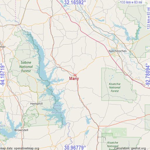
Many GPS coordinates[2]
31° 34' 7.608" North, 93° 29' 2.616" West
| Map corner | latitude | longitude |
|---|---|---|
| Upper-left | 32.16592°, | -94.18719° |
| Center: | 31.56878°, | -93.48406° |
| Lower-right: | 30.96779°, | -92.78094° |
| Map W x H: | 133.2×133.2 km | = 82.8×82.8mi |
| max Lat: | 71.29058° ⇑89.5% North |
| Many: | 31.56878° |
| min Lat: | ⇓10.5% South 19.06759° |
| min Long | Many | max Long |
| -171.73463° | -93.48406° | -66.98998° |
| W 32.5%⇐ | ⇒67.5% E |
Elevation
Elevation of Many is 85 m = 279 ft, and this is 209.8 m = 688 ft below average elevation for this country.
| Max E: |
3189 m = 10463 ft | 72.7% |
| Avg. | 294.8 m = 967 ft | |
| Many | 85 m = 279 ft | |
Min E: |
-60 m = -197 ft | 27.3% |
See also: United States elevation on elevation.city.
Geographical zone
Many is located in North temperate zone (between Tropic of Cancer and the Arctic Circle). Distance of this Northern Tropic circle is 904.2 km =561.8 mi to South.| Distance of | km | miles | from Many |
|---|---|---|---|
| North Pole | 6496.9 | 4037 | to North |
| Arctic Circle | 3891.1 | 2417.8 | to North |
| Tropic Cancer | 904.2 | 561.8 | to South |
| Equator | 3510.1 | 2181.1 | to South |


Nearby cities:
15 places around Many: (largest is in red/bold)
• Anacoco
37.7 km =23.4 mi,  158°
158°
• Campti
50 km =31.1 mi,  43°
43°
• Coushatta
51.4 km =31.9 mi,  15°
15°
• Florien
14.1 km =8.8 mi,  169°
169°
• Fort Jesup
9.1 km =5.7 mi,  57°
57°
• Hemphill
42.7 km =26.5 mi,  233°
233°
• Leesville
51.8 km =32.2 mi, 155°
• Milam
37.5 km =23.3 mi,  246°
246°
• Natchez
43.3 km =26.9 mi,  74°
74°
• Natchitoches
43.3 km =26.9 mi, 60°
• Pleasant Hill
28.1 km =17.5 mi,  354°
354°
• Provencal
28.3 km =17.6 mi, 70°
• South Toledo Bend
47.6 km =29.6 mi,  193°
193°
• Vienna Bend
45.7 km =28.4 mi, 66°
• Zwolle
16.7 km =10.4 mi,  294°
294°
Sources, notices
• [Note1] Compared only with cities in United States existing in our database
• [Src1] Map data: © OpenStreetMap contributors (CC-BY-SA)
• [Src2] Other city data from geonames.org with taken over terms of usage.
• [Src3] Geographical zone / Annual Mean Temperature by Robert A. Rohde @ Wikipedia
