Pineville geodata
Pineville (Louisiana) is a populated place; located in United States in America/Chicago (GMT-5) time zone. With population of 14,403 people, there are 3357 cities with bigger population in this country. Compared to other cities in United States, 90% of cities are located further ↑North; 65% of cities are located further →East and 81.8% of cities have higher elevation than Pineville. Note1


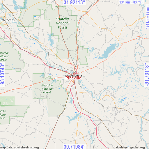
Pineville GPS coordinates[2]
31° 19' 20.64" North, 92° 26' 3.48" West
| Map corner | latitude | longitude |
|---|---|---|
| Upper-left | 31.92113°, | -93.13743° |
| Center: | 31.3224°, | -92.4343° |
| Lower-right: | 30.71984°, | -91.73118° |
| Map W x H: | 133.6×133.6 km | = 83×83mi |
| max Lat: | 71.29058° ⇑90% North |
| Pineville: | 31.3224° |
| min Lat: | ⇓10% South 19.06759° |
| min Long | Pineville | max Long |
| -171.73463° | -92.4343° | -66.98998° |
| W 35%⇐ | ⇒65% E |
Elevation
Elevation of Pineville is 39 m = 128 ft, and this is 255.8 m = 839 ft below average elevation for this country.
| Max E: |
3189 m = 10463 ft | 81.8% |
| Avg. | 294.8 m = 967 ft | |
| Pineville | 39 m = 128 ft | |
Min E: |
-60 m = -197 ft | 18.2% |
See also: United States elevation on elevation.city.
Geographical zone
Pineville is located in North temperate zone (between Tropic of Cancer and the Arctic Circle). Distance of this Northern Tropic circle is 876.8 km =544.8 mi to South.| Distance of | km | miles | from Pineville |
|---|---|---|---|
| North Pole | 6524.3 | 4054 | to North |
| Arctic Circle | 3918.4 | 2434.8 | to North |
| Tropic Cancer | 876.8 | 544.8 | to South |
| Equator | 3482.7 | 2164 | to South |


Nearby cities:
15 places around Pineville: (largest is in red/bold)
• Alexandria
1.6 km =1 mi,  219°
219°
• Ball
10.6 km =6.6 mi,  11°
11°
• Boyce
23.6 km =14.7 mi,  288°
288°
• Bunkie
47.5 km =29.5 mi,  149°
149°
• Cheneyville
36.9 km =22.9 mi,  157°
157°
• Colfax
33.9 km =21.1 mi,  310°
310°
• Deville
25.8 km =16 mi,  81°
81°
• Fifth Ward
32.8 km =20.4 mi,  130°
130°
• Forest Hill
32.5 km =20.2 mi,  196°
196°
• Glenmora
41 km =25.5 mi, 200°
• Hessmer
41.7 km =25.9 mi, 134°
• Lecompte
25.5 km =15.8 mi,  172°
172°
• Mansura
47 km =29.2 mi, 128°
• Marksville
41.1 km =25.5 mi,  121°
121°
• Woodworth
20.4 km =12.7 mi, 197°
Sources, notices
• [Note1] Compared only with cities in United States existing in our database
• [Src1] Map data: © OpenStreetMap contributors (CC-BY-SA)
• [Src2] Other city data from geonames.org with taken over terms of usage.
• [Src3] Geographical zone / Annual Mean Temperature by Robert A. Rohde @ Wikipedia
