Ringgold geodata
Ringgold (Louisiana) is a populated place; located in United States in America/Chicago (GMT-5) time zone. With population of 1,432 people, there are 13954 cities with bigger population in this country. Compared to other cities in United States, 87.7% of cities are located further ↑North; 66.9% of cities are located further →East and 72.1% of cities have higher elevation than Ringgold. Note1


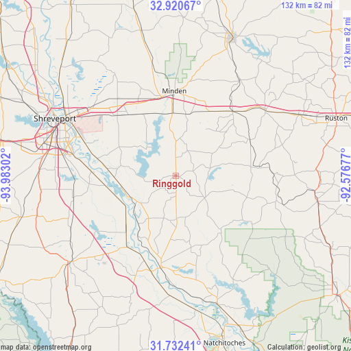
Ringgold GPS coordinates[2]
32° 19' 42.564" North, 93° 16' 47.604" West
| Map corner | latitude | longitude |
|---|---|---|
| Upper-left | 32.92067°, | -93.98302° |
| Center: | 32.32849°, | -93.27989° |
| Lower-right: | 31.73241°, | -92.57677° |
| Map W x H: | 132.1×132.1 km | = 82.1×82.1mi |
| max Lat: | 71.29058° ⇑87.7% North |
| Ringgold: | 32.32849° |
| min Lat: | ⇓12.3% South 19.06759° |
| min Long | Ringgold | max Long |
| -171.73463° | -93.27989° | -66.98998° |
| W 33.1%⇐ | ⇒66.9% E |
Elevation
Elevation of Ringgold is 88 m = 289 ft, and this is 206.8 m = 678 ft below average elevation for this country.
| Max E: |
3189 m = 10463 ft | 72.1% |
| Avg. | 294.8 m = 967 ft | |
| Ringgold | 88 m = 289 ft | |
Min E: |
-60 m = -197 ft | 27.9% |
See also: United States elevation on elevation.city.
Geographical zone
Ringgold is located in North temperate zone (between Tropic of Cancer and the Arctic Circle). Distance of this Northern Tropic circle is 988.7 km =614.3 mi to South.| Distance of | km | miles | from Ringgold |
|---|---|---|---|
| North Pole | 6412.5 | 3984.5 | to North |
| Arctic Circle | 3806.6 | 2365.3 | to North |
| Tropic Cancer | 988.7 | 614.3 | to South |
| Equator | 3594.6 | 2233.6 | to South |


Nearby cities:
15 places around Ringgold: (largest is in red/bold)
• Arcadia
41.7 km =25.9 mi,  54°
54°
• Bossier City
47.3 km =29.4 mi,  296°
296°
• Campti
50.7 km =31.5 mi,  162°
162°
• Coushatta
35.4 km =22 mi,  189°
189°
• Doyline
26.1 km =16.2 mi,  331°
331°
• Eastwood
37 km =23 mi,  313°
313°
• Gibsland
32.1 km =19.9 mi,  41°
41°
• Haughton
31 km =19.3 mi,  317°
317°
• Mansfield
51.1 km =31.8 mi,  230°
230°
• Martin
27.6 km =17.1 mi,  168°
168°
• Minden
31.9 km =19.8 mi,  358°
358°
• Red Chute
40.2 km =25 mi, 308°
• Shreveport
49.3 km =30.6 mi, 296°
• Sibley
23.5 km =14.6 mi, 356°
• Stonewall
51.4 km =31.9 mi,  264°
264°
Sources, notices
• [Note1] Compared only with cities in United States existing in our database
• [Src1] Map data: © OpenStreetMap contributors (CC-BY-SA)
• [Src2] Other city data from geonames.org with taken over terms of usage.
• [Src3] Geographical zone / Annual Mean Temperature by Robert A. Rohde @ Wikipedia
