Urania geodata
Urania (Louisiana) is a populated place; located in United States in America/Chicago (GMT-5) time zone. With population of 1,316 people, there are 14516 cities with bigger population in this country. Compared to other cities in United States, 88.9% of cities are located further ↑North; 64.8% of cities are located further →East and 84.1% of cities have higher elevation than Urania. Note1


Urania GPS coordinates[2]
31° 51' 49.608" North, 92° 17' 45.492" West
| Map corner | latitude | longitude |
|---|---|---|
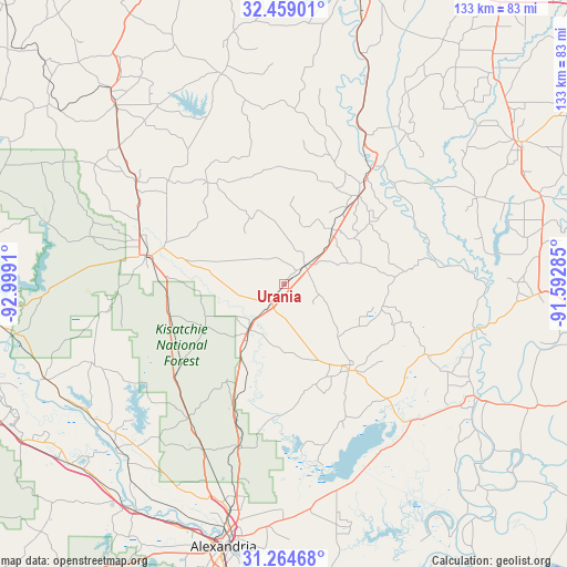
| Upper-left | 32.45901°, | -92.9991° |
| Center: | 31.86378°, | -92.29597° |
| Lower-right: | 31.26468°, | -91.59285° |
| Map W x H: | 132.8×132.8 km | = 82.5×82.5mi |
| max Lat: | 71.29058° ⇑88.9% North |
| Urania: | 31.86378° |
| min Lat: | ⇓11.1% South 19.06759° |
| min Long | Urania | max Long |
| -171.73463° | -92.29597° | -66.98998° |
| W 35.2%⇐ | ⇒64.8% E |
Elevation
Elevation of Urania is 31 m = 102 ft, and this is 263.8 m = 865 ft below average elevation for this country.
| Max E: |
3189 m = 10463 ft | 84.1% |
| Avg. | 294.8 m = 967 ft | |
| Urania | 31 m = 102 ft | |
Min E: |
-60 m = -197 ft | 15.9% |
See also: United States elevation on elevation.city.
Geographical zone
Urania is located in North temperate zone (between Tropic of Cancer and the Arctic Circle). Distance of this Northern Tropic circle is 937 km =582.2 mi to South.| Distance of | km | miles | from Urania |
|---|---|---|---|
| North Pole | 6464.1 | 4016.6 | to North |
| Arctic Circle | 3858.3 | 2397.4 | to North |
| Tropic Cancer | 937 | 582.2 | to South |
| Equator | 3542.9 | 2201.5 | to South |


Nearby cities:
15 places around Urania: (largest is in red/bold)
• Ball
51 km =31.7 mi,  192°
192°
• Banks Springs
30.9 km =19.2 mi,  38°
38°
• Chatham
51.3 km =31.9 mi,  343°
343°
• Clarks
23.4 km =14.5 mi, 39°
• Colfax
54.6 km =33.9 mi,  225°
225°
• Columbia
33.8 km =21 mi, 37°
• Deville
57.6 km =35.8 mi,  167°
167°
• Grayson
27.2 km =16.9 mi, 40°
• Harrisonburg
46 km =28.6 mi,  102°
102°
• Jena
25.3 km =15.7 mi,  142°
142°
• Jonesville
52.3 km =32.5 mi,  120°
120°
• Midway
23.4 km =14.5 mi, 144°
• Olla
6.6 km =4.1 mi,  48°
48°
• Wallace Ridge
47.5 km =29.5 mi,  111°
111°
• Winnfield
33.3 km =20.7 mi,  281°
281°
Sources, notices
• [Note1] Compared only with cities in United States existing in our database
• [Src1] Map data: © OpenStreetMap contributors (CC-BY-SA)
• [Src2] Other city data from geonames.org with taken over terms of usage.
• [Src3] Geographical zone / Annual Mean Temperature by Robert A. Rohde @ Wikipedia
