Byrnes Mill geodata
Byrnes Mill (Missouri) is a populated place; located in United States in America/Chicago (GMT-5) time zone. With population of 2,888 people, there are 9829 cities with bigger population in this country. Compared to other cities in United States, 59.1% of cities are located further ↑North; 61.1% of cities are located further →East and 61.1% of cities have higher elevation than Byrnes Mill. Note1
Administrative division(s):
- Level 1: Missouri
- Level 2: Jefferson County
- Level 3: Township of High Ridge


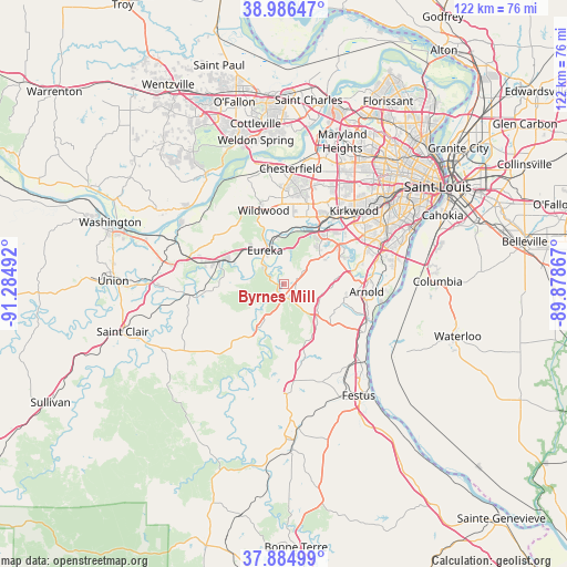
Byrnes Mill GPS coordinates[2]
38° 26' 16.188" North, 90° 34' 54.444" West
| Map corner | latitude | longitude |
|---|---|---|
| Upper-left | 38.98647°, | -91.28492° |
| Center: | 38.43783°, | -90.58179° |
| Lower-right: | 37.88499°, | -89.87867° |
| Map W x H: | 122.5×122.5 km | = 76.1×76.1mi |
| max Lat: | 71.29058° ⇑59.1% North |
| Byrnes Mill: | 38.43783° |
| min Lat: | ⇓40.9% South 19.06759° |
| min Long | Byrnes Mill | max Long |
| -171.73463° | -90.58179° | -66.98998° |
| W 38.9%⇐ | ⇒61.1% E |
Elevation
Elevation of Byrnes Mill is 149 m = 489 ft, and this is 145.8 m = 478 ft below average elevation for this country.
| Max E: |
3189 m = 10463 ft | 61.1% |
| Avg. | 294.8 m = 967 ft | |
| Byrnes Mill | 149 m = 489 ft | |
Min E: |
-60 m = -197 ft | 38.9% |
See also: United States elevation on elevation.city.
Geographical zone
Byrnes Mill is located in North temperate zone (between Tropic of Cancer and the Arctic Circle). Distance of this Northern Tropic circle is 1668 km =1036.4 mi to South.| Distance of | km | miles | from Byrnes Mill |
|---|---|---|---|
| North Pole | 5733.2 | 3562.4 | to North |
| Arctic Circle | 3127.3 | 1943.2 | to North |
| Tropic Cancer | 1668 | 1036.4 | to South |
| Equator | 4273.9 | 2655.7 | to South |


Nearby cities:
15 places around Byrnes Mill: (largest is in red/bold)
• Arnold
17.8 km =11.1 mi,  91°
91°
• Ballwin
17.8 km =11.1 mi,  10°
10°
• Cedar Hill
10.7 km =6.6 mi,  208°
208°
• Ellisville
17.2 km =10.7 mi,  358°
358°
• Eureka
8.2 km =5.1 mi,  330°
330°
• Fenton
15.2 km =9.4 mi,  56°
56°
• High Ridge
4.6 km =2.9 mi, 59°
• LaBarque Creek
8.9 km =5.5 mi,  254°
254°
• Manchester
18.8 km =11.7 mi,  19°
19°
• Murphy
10.1 km =6.3 mi,  54°
54°
• Pacific
14.7 km =9.1 mi,  289°
289°
• Sunset Hills
18.9 km =11.7 mi, 53°
• Valley Park
14.6 km =9.1 mi,  32°
32°
• Wildwood
17.6 km =10.9 mi,  336°
336°
• Winchester
17.6 km =10.9 mi, 15°
Sources, notices
• [Note1] Compared only with cities in United States existing in our database
• [Src1] Map data: © OpenStreetMap contributors (CC-BY-SA)
• [Src2] Other city data from geonames.org with taken over terms of usage.
• [Src3] Geographical zone / Annual Mean Temperature by Robert A. Rohde @ Wikipedia
