Jefferson City geodata
Jefferson City (Missouri) is a seat of a first-order administrative division; located in United States in America/Chicago (GMT-5) time zone. With population of 43,169 people, there are 1107 cities with bigger population in this country. Compared to other cities in United States, 58.3% of cities are located further ↑North; 64.5% of cities are located further →East and 50.8% of cities have higher elevation than Jefferson City. Note1


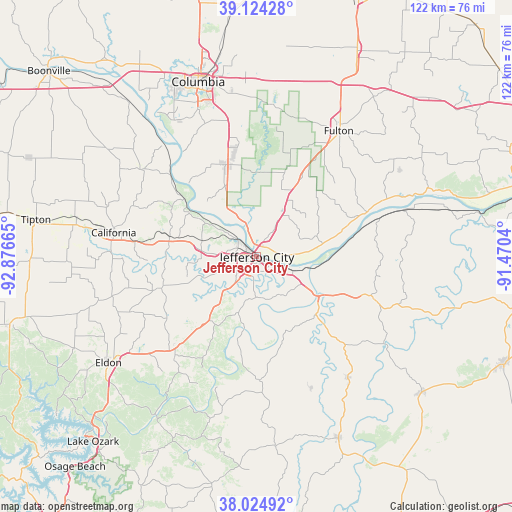
Jefferson City GPS coordinates[2]
38° 34' 36.12" North, 92° 10' 24.672" West
| Map corner | latitude | longitude |
|---|---|---|
| Upper-left | 39.12428°, | -92.87665° |
| Center: | 38.5767°, | -92.17352° |
| Lower-right: | 38.02492°, | -91.4704° |
| Map W x H: | 122.2×122.2 km | = 75.9×75.9mi |
| max Lat: | 71.29058° ⇑58.3% North |
| Jefferson City: | 38.5767° |
| min Lat: | ⇓41.7% South 19.06759° |
| min Long | Jefferson City | max Long |
| -171.73463° | -92.17352° | -66.98998° |
| W 35.5%⇐ | ⇒64.5% E |
Elevation
Elevation of Jefferson City is 195 m = 640 ft, and this is 99.8 m = 327 ft below average elevation for this country.
| Max E: |
3189 m = 10463 ft | 50.8% |
| Avg. | 294.8 m = 967 ft | |
| Jefferson City | 195 m = 640 ft | |
Min E: |
-60 m = -197 ft | 49.2% |
See also: Jefferson City elevation on elevation.city.
Geographical zone
Jefferson City is located in North temperate zone (between Tropic of Cancer and the Arctic Circle). Distance of this Northern Tropic circle is 1683.4 km =1046 mi to South.| Distance of | km | miles | from Jefferson City |
|---|---|---|---|
| North Pole | 5717.7 | 3552.8 | to North |
| Arctic Circle | 3111.8 | 1933.6 | to North |
| Tropic Cancer | 1683.4 | 1046 | to South |
| Equator | 4289.3 | 2665.2 | to South |


Nearby cities:
15 places around Jefferson City: (largest is in red/bold)
• Ashland
23.2 km =14.4 mi,  341°
341°
• Belle
51 km =31.7 mi,  129°
129°
• California
34.6 km =21.5 mi,  279°
279°
• Columbia
44 km =27.3 mi, 341°
• Eldon
43.7 km =27.2 mi,  234°
234°
• Fulton
35.8 km =22.2 mi,  33°
33°
• Holts Summit
8.4 km =5.2 mi, 32°
• Linn
29.9 km =18.6 mi,  109°
109°
• New Bloomfield
17.5 km =10.9 mi,  24°
24°
• Russellville
24.3 km =15.1 mi,  252°
252°
• Saint Martins
14.4 km =8.9 mi, 277°
• Taos
11.9 km =7.4 mi, 131°
• Tuscumbia
45.6 km =28.3 mi,  213°
213°
• Vienna
47.6 km =29.6 mi,  155°
155°
• Wardsville
9.8 km =6.1 mi,  180°
180°
Sources, notices
• [Note1] Compared only with cities in United States existing in our database
• [Src1] Map data: © OpenStreetMap contributors (CC-BY-SA)
• [Src2] Other city data from geonames.org with taken over terms of usage.
• [Src3] Geographical zone / Annual Mean Temperature by Robert A. Rohde @ Wikipedia
