Carthage geodata
Carthage (Mississippi) is a seat of a second-order administrative division; located in United States in America/Chicago (GMT-5) time zone. With population of 4,899 people, there are 7268 cities with bigger population in this country. Compared to other cities in United States, 86.3% of cities are located further ↑North; 57.6% of cities are located further →East and 68.8% of cities have higher elevation than Carthage. Note1


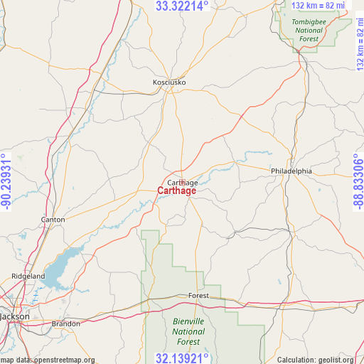
Carthage GPS coordinates[2]
32° 43' 57.504" North, 89° 32' 10.248" West
| Map corner | latitude | longitude |
|---|---|---|
| Upper-left | 33.32214°, | -90.23931° |
| Center: | 32.73264°, | -89.53618° |
| Lower-right: | 32.13921°, | -88.83306° |
| Map W x H: | 131.5×131.5 km | = 81.7×81.7mi |
| max Lat: | 71.29058° ⇑86.3% North |
| Carthage: | 32.73264° |
| min Lat: | ⇓13.7% South 19.06759° |
| min Long | Carthage | max Long |
| -171.73463° | -89.53618° | -66.98998° |
| W 42.4%⇐ | ⇒57.6% E |
Elevation
Elevation of Carthage is 108 m = 354 ft, and this is 186.8 m = 613 ft below average elevation for this country.
| Max E: |
3189 m = 10463 ft | 68.8% |
| Avg. | 294.8 m = 967 ft | |
| Carthage | 108 m = 354 ft | |
Min E: |
-60 m = -197 ft | 31.2% |
See also: United States elevation on elevation.city.
Geographical zone
Carthage is located in North temperate zone (between Tropic of Cancer and the Arctic Circle). Distance of this Northern Tropic circle is 1033.6 km =642.2 mi to South.| Distance of | km | miles | from Carthage |
|---|---|---|---|
| North Pole | 6367.5 | 3956.6 | to North |
| Arctic Circle | 3761.6 | 2337.3 | to North |
| Tropic Cancer | 1033.6 | 642.2 | to South |
| Equator | 3639.5 | 2261.5 | to South |


Nearby cities:
15 places around Carthage: (largest is in red/bold)
• Coldwater
30.2 km =18.8 mi,  93°
93°
• Conehatta
39.1 km =24.3 mi,  143°
143°
• Deemer
39.1 km =24.3 mi, 87°
• Forest
41.3 km =25.7 mi,  171°
171°
• Goodman
44 km =27.3 mi,  306°
306°
• Hillsboro
30.5 km =19 mi,  175°
175°
• Kosciusko
36.5 km =22.7 mi,  352°
352°
• Morton
43.6 km =27.1 mi,  194°
194°
• Pearl River
29.4 km =18.3 mi,  78°
78°
• Philadelphia
39.5 km =24.5 mi, 83°
• Pickens
44 km =27.3 mi,  292°
292°
• Redwater
3.8 km =2.4 mi,  359°
359°
• Standing Pine
11.6 km =7.2 mi,  124°
124°
• Union
42.8 km =26.6 mi,  114°
114°
• Walnut Grove
17.4 km =10.8 mi,  155°
155°
Sources, notices
• [Note1] Compared only with cities in United States existing in our database
• [Src1] Map data: © OpenStreetMap contributors (CC-BY-SA)
• [Src2] Other city data from geonames.org with taken over terms of usage.
• [Src3] Geographical zone / Annual Mean Temperature by Robert A. Rohde @ Wikipedia
