Southmont geodata
Southmont (North Carolina) is a populated place; located in United States in America/New_York (GMT-4) time zone. With population of 1,470 people, there are 13792 cities with bigger population in this country. Compared to other cities in United States, 71.9% of cities are located further ↑North; 71.8% of cities are located further ←West and 53% of cities have lower elevation than Southmont. Note1
Administrative division(s):
- Level 1: North Carolina
- Level 2: Davidson County
- Level 3: Township of Cotton Grove


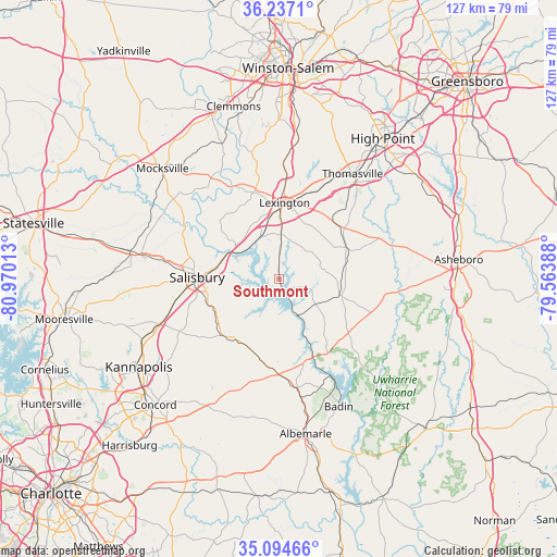
Southmont GPS coordinates[2]
35° 40' 4.512" North, 80° 16' 1.2" West
| Map corner | latitude | longitude |
|---|---|---|
| Upper-left | 36.2371°, | -80.97013° |
| Center: | 35.66792°, | -80.267° |
| Lower-right: | 35.09466°, | -79.56388° |
| Map W x H: | 127×127 km | = 78.9×78.9mi |
| max Lat: | 71.29058° ⇑71.9% North |
| Southmont: | 35.66792° |
| min Lat: | ⇓28.1% South 19.06759° |
| min Long | Southmont | max Long |
| -171.73463° | -80.267° | -66.98998° |
| W 71.8%⇐ | ⇒28.2% E |
Elevation
Elevation of Southmont is 210 m = 689 ft, and this is 84.8 m = 278 ft below average elevation for this country.
| Max E: |
3189 m = 10463 ft | 47% |
| Avg. | 294.8 m = 967 ft | |
| Southmont | 210 m = 689 ft | |
Min E: |
-60 m = -197 ft | 53% |
See also: United States elevation on elevation.city.
Geographical zone
Southmont is located in North temperate zone (between Tropic of Cancer and the Arctic Circle). Distance of this Northern Tropic circle is 1360 km =845.1 mi to South.| Distance of | km | miles | from Southmont |
|---|---|---|---|
| North Pole | 6041.2 | 3753.8 | to North |
| Arctic Circle | 3435.3 | 2134.6 | to North |
| Tropic Cancer | 1360 | 845.1 | to South |
| Equator | 3965.9 | 2464.3 | to South |


Nearby cities:
15 places around Southmont: (largest is in red/bold)
• Denton
14.2 km =8.8 mi,  105°
105°
• East Spencer
15 km =9.3 mi,  275°
275°
• Faith
19.9 km =12.4 mi,  243°
243°
• Franklin
21.8 km =13.5 mi,  285°
285°
• Granite Quarry
17.4 km =10.8 mi,  249°
249°
• Lexington
17.4 km =10.8 mi,  4°
4°
• Misenheimer
20.4 km =12.7 mi,  185°
185°
• New London
25.4 km =15.8 mi,  170°
170°
• Richfield
22 km =13.7 mi,  177°
177°
• Rockwell
18.1 km =11.2 mi,  224°
224°
• Salisbury
18.7 km =11.6 mi,  271°
271°
• Spencer
15.4 km =9.6 mi, 280°
• Thomasville
29.1 km =18.1 mi,  34°
34°
• Tyro
18.4 km =11.4 mi,  328°
328°
• Welcome
26.1 km =16.2 mi, 1°
Sources, notices
• [Note1] Compared only with cities in United States existing in our database
• [Src1] Map data: © OpenStreetMap contributors (CC-BY-SA)
• [Src2] Other city data from geonames.org with taken over terms of usage.
• [Src3] Geographical zone / Annual Mean Temperature by Robert A. Rohde @ Wikipedia
