Walnut Creek geodata
Walnut Creek (North Carolina) is a populated place; located in United States in America/New_York (GMT-4) time zone. With population of 861 people, there are 17277 cities with bigger population in this country. Compared to other cities in United States, 73.6% of cities are located further ↑North; 78.1% of cities are located further ←West and 83.2% of cities have higher elevation than Walnut Creek. Note1
Administrative division(s):
- Level 1: North Carolina
- Level 2: Wayne County
- Level 3: Township of New Hope


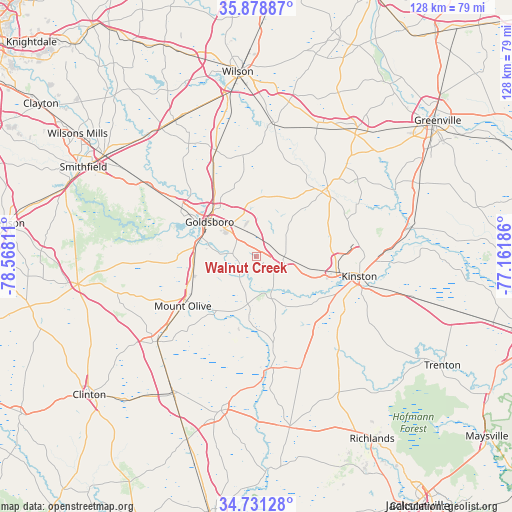
Walnut Creek GPS coordinates[2]
35° 18' 25.596" North, 77° 51' 53.928" West
| Map corner | latitude | longitude |
|---|---|---|
| Upper-left | 35.87887°, | -78.56811° |
| Center: | 35.30711°, | -77.86498° |
| Lower-right: | 34.73128°, | -77.16186° |
| Map W x H: | 127.6×127.6 km | = 79.3×79.3mi |
| max Lat: | 71.29058° ⇑73.6% North |
| Walnut Creek: | 35.30711° |
| min Lat: | ⇓26.4% South 19.06759° |
| min Long | Walnut Creek | max Long |
| -171.73463° | -77.86498° | -66.98998° |
| W 78.1%⇐ | ⇒21.9% E |
Elevation
Elevation of Walnut Creek is 34 m = 112 ft, and this is 260.8 m = 856 ft below average elevation for this country.
| Max E: |
3189 m = 10463 ft | 83.2% |
| Avg. | 294.8 m = 967 ft | |
| Walnut Creek | 34 m = 112 ft | |
Min E: |
-60 m = -197 ft | 16.8% |
See also: United States elevation on elevation.city.
Geographical zone
Walnut Creek is located in North temperate zone (between Tropic of Cancer and the Arctic Circle). Distance of this Northern Tropic circle is 1319.9 km =820.1 mi to South.| Distance of | km | miles | from Walnut Creek |
|---|---|---|---|
| North Pole | 6081.3 | 3778.7 | to North |
| Arctic Circle | 3475.4 | 2159.5 | to North |
| Tropic Cancer | 1319.9 | 820.1 | to South |
| Equator | 3925.8 | 2439.4 | to South |


Nearby cities:
15 places around Walnut Creek: (largest is in red/bold)
• Brogden
15.5 km =9.6 mi,  264°
264°
• Calypso
27.7 km =17.2 mi,  232°
232°
• Elroy
5.6 km =3.5 mi,  314°
314°
• Faison
32.5 km =20.2 mi, 229°
• Fremont
28.3 km =17.6 mi,  339°
339°
• Goldsboro
14.5 km =9 mi, 306°
• Kinston
26.2 km =16.3 mi,  100°
100°
• La Grange
7 km =4.3 mi,  90°
90°
• Mar-Mac
17.6 km =10.9 mi,  280°
280°
• Maury
31.9 km =19.8 mi,  52°
52°
• Mount Olive
22 km =13.7 mi,  236°
236°
• Pikeville
23.6 km =14.7 mi,  333°
333°
• Pink Hill
30 km =18.6 mi,  158°
158°
• Princeton
32.1 km =19.9 mi,  303°
303°
• Snow Hill
23.1 km =14.4 mi, 46°
Sources, notices
• [Note1] Compared only with cities in United States existing in our database
• [Src1] Map data: © OpenStreetMap contributors (CC-BY-SA)
• [Src2] Other city data from geonames.org with taken over terms of usage.
• [Src3] Geographical zone / Annual Mean Temperature by Robert A. Rohde @ Wikipedia
